You are here: Home > Network List > IC - New China Digital Seismograph Network Stations List
> Station HIA Hailar, Neimenggu Autonomous Region, China > Earthquake Result Viewer
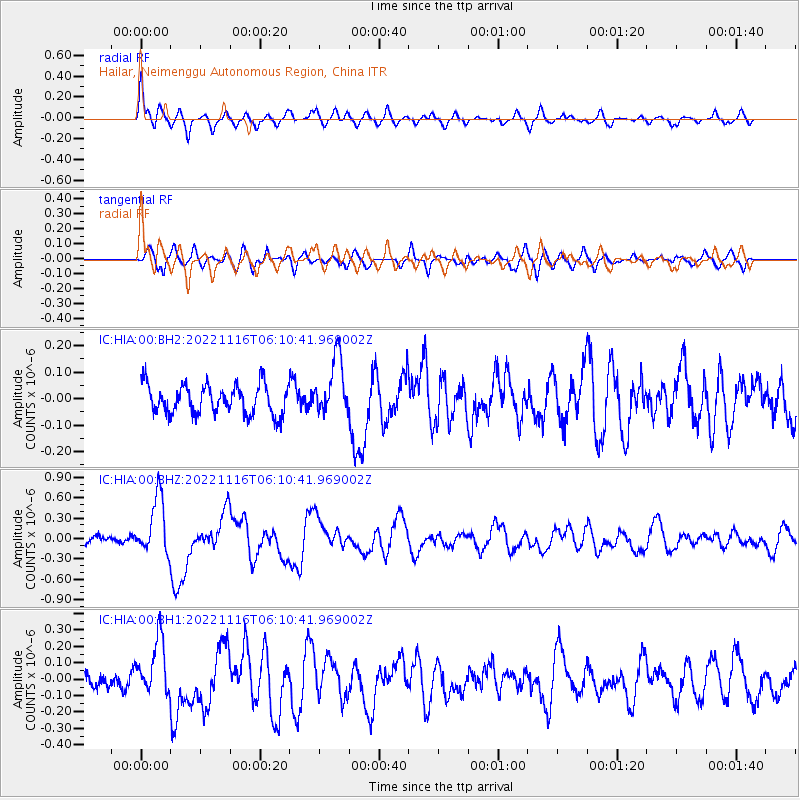
HIA Hailar, Neimenggu Autonomous Region, China - Earthquake Result Viewer
*The percent match for this event was below the threshold and hence no stack was calculated.
| Earthquake location: |
Southwest Of Sumatra, Indonesia |
| Earthquake latitude/longitude: |
-4.7/100.8 |
| Earthquake time(UTC): |
2022/11/16 (320) 06:01:32 GMT |
| Earthquake Depth: |
9.0 km |
| Earthquake Magnitude: |
5.5 mww |
| Earthquake Catalog/Contributor: |
NEIC PDE/us |
|
| Network: |
IC New China Digital Seismograph Network |
| Station: |
HIA Hailar, Neimenggu Autonomous Region, China |
| Lat/Lon: |
49.27 N/119.74 E |
| Elevation: |
620 m |
|
| Distance: |
56.3 deg |
| Az: |
14.833 deg |
| Baz: |
202.925 deg |
| Ray Param: |
$rayparam |
*The percent match for this event was below the threshold and hence was not used in the summary stack. |
|
| Radial Match: |
75.96377 % |
| Radial Bump: |
400 |
| Transverse Match: |
63.19598 % |
| Transverse Bump: |
400 |
| SOD ConfigId: |
29823551 |
| Insert Time: |
2022-11-30 06:05:53.894 +0000 |
| GWidth: |
2.5 |
| Max Bumps: |
400 |
| Tol: |
0.001 |
|
Signal To Noise
| Channel | StoN | STA | LTA |
| IC:HIA:00:BHZ:20221116T06:10:41.969002Z | 5.004409 | 4.1901473E-7 | 8.372911E-8 |
| IC:HIA:00:BH1:20221116T06:10:41.969002Z | 3.7574015 | 1.7297388E-7 | 4.603551E-8 |
| IC:HIA:00:BH2:20221116T06:10:41.969002Z | 1.9396638 | 1.07889804E-7 | 5.5622944E-8 |
| Arrivals |
| Ps | |
| PpPs | |
| PsPs/PpSs | |


