MM14 Brooklyn, Indiana - Earthquake Result Viewer
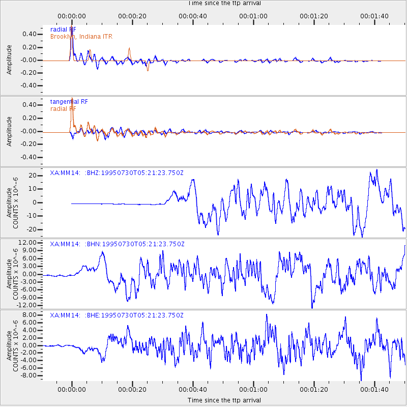
Earthquake location: Near Coast Of Northern Chile
Earthquake latitude/longitude: -23.4/-70.3
Earthquake time(UTC): 1995/07/30 (211) 05:11:23 GMT
Earthquake Depth: 47 km
Earthquake Magnitude: 6.6 MB, 7.3 MS, 7.2 UNKNOWN, 8.1 MW
Earthquake Catalog/Contributor: WHDF/NEIC
Network: XA Missouri to Massachusetts Transect
Station: MM14 Brooklyn, Indiana
Lat/Lon: 39.55 N/86.39 W
Elevation: 290 m
Distance: 64.4 deg
Az: 346.257 deg
Baz: 163.598 deg
Ray Param: 0.05887347
Estimated Moho Depth: 44.75 km
Estimated Crust Vp/Vs: 1.75
Assumed Crust Vp: 6.444 km/s
Estimated Crust Vs: 3.672 km/s
Estimated Crust Poisson's Ratio: 0.26
Radial Match: 96.07906 %
Radial Bump: 398
Transverse Match: 91.34649 %
Transverse Bump: 400
SOD ConfigId: 6273
Insert Time: 2010-02-26 17:53:40.741 +0000
GWidth: 2.5
Max Bumps: 400
Tol: 0.001

Signal To Noise

ChannelStoNSTALTA
XA:MM14: :BHN:19950730T05:21:23.750Z14.2904461.9671222E-61.3765295E-7
XA:MM14: :BHE:19950730T05:21:23.750Z14.2511059.3905135E-76.5893225E-8
XA:MM14: :BHZ:19950730T05:21:23.750Z25.7809754.9542637E-61.9216742E-7
Arrivals
Ps5.5 SECOND
PpPs18 SECOND
PsPs/PpSs24 SECOND