MM15 Terra Haute, Indiana - Earthquake Result Viewer
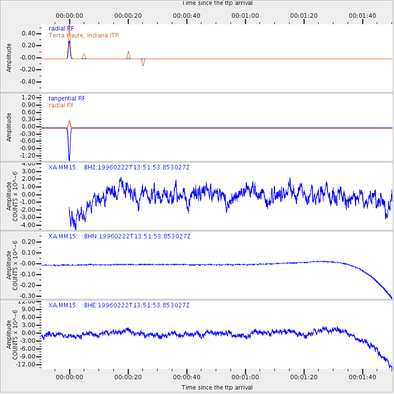
Earthquake location: Near Coast Of Central Chile
Earthquake latitude/longitude: -33.7/-71.7
Earthquake time(UTC): 1996/02/22 (053) 13:40:53 GMT
Earthquake Depth: 44 km
Earthquake Magnitude: 5.9 MB, 5.5 MS, 6.0 UNKNOWN, 5.9 MW
Earthquake Catalog/Contributor: WHDF/NEIC
Network: XA Missouri to Massachusetts Transect
Station: MM15 Terra Haute, Indiana
Lat/Lon: 39.29 N/87.31 W
Elevation: 191 m
Distance: 74.0 deg
Az: 347.459 deg
Baz: 166.509 deg
Ray Param: 0.052517068
Estimated Moho Depth: 10.0 km
Estimated Crust Vp/Vs: 1.60
Assumed Crust Vp: 6.444 km/s
Estimated Crust Vs: 4.027 km/s
Estimated Crust Poisson's Ratio: 0.18
Radial Match: 99.90812 %
Radial Bump: 15
Transverse Match: 99.91667 %
Transverse Bump: 14
SOD ConfigId: 29242
Insert Time: 2010-02-26 17:54:27.988 +0000
GWidth: 2.5
Max Bumps: 400
Tol: 0.001

Signal To Noise

ChannelStoNSTALTA
XA:MM15: :BHN:19960222T13:51:53.853027Z0.88387092.2679801E-82.565963E-8
XA:MM15: :BHE:19960222T13:51:53.853027Z1.27129331.5347139E-61.2072068E-6
XA:MM15: :BHZ:19960222T13:51:53.853027Z0.547242768.3515687E-71.5261178E-6
Arrivals
Ps1.0 SECOND
PpPs3.9 SECOND
PsPs/PpSs4.9 SECOND