MM17 Lake Carlyle, Illinois - Earthquake Result Viewer
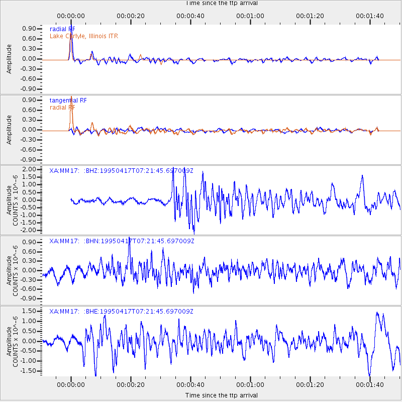
Earthquake location: Northern Mid-Atlantic Ridge
Earthquake latitude/longitude: 33.8/-38.6
Earthquake time(UTC): 1995/04/17 (107) 07:14:35 GMT
Earthquake Depth: 10 km
Earthquake Magnitude: 5.8 MB, 5.8 MS, 5.9 UNKNOWN, 6.1 MW
Earthquake Catalog/Contributor: WHDF/NEIC
Network: XA Missouri to Massachusetts Transect
Station: MM17 Lake Carlyle, Illinois
Lat/Lon: 38.67 N/89.33 W
Elevation: 144 m
Distance: 40.8 deg
Az: 291.937 deg
Baz: 80.742 deg
Ray Param: 0.07419302
Estimated Moho Depth: 46.25 km
Estimated Crust Vp/Vs: 1.93
Assumed Crust Vp: 6.444 km/s
Estimated Crust Vs: 3.334 km/s
Estimated Crust Poisson's Ratio: 0.32
Radial Match: 88.39085 %
Radial Bump: 340
Transverse Match: 59.090942 %
Transverse Bump: 400
SOD ConfigId: 6273
Insert Time: 2010-02-26 17:56:11.743 +0000
GWidth: 2.5
Max Bumps: 400
Tol: 0.001

Signal To Noise

ChannelStoNSTALTA
XA:MM17: :BHN:19950417T07:21:45.697009Z1.23751491.8718104E-71.5125559E-7
XA:MM17: :BHE:19950417T07:21:45.697009Z4.54244853.912478E-78.613148E-8
XA:MM17: :BHZ:19950417T07:21:45.697009Z5.20894676.228341E-71.1957006E-7
Arrivals
Ps7.1 SECOND
PpPs20 SECOND
PsPs/PpSs27 SECOND