
MM17 Lake Carlyle, Illinois - Earthquake Result Viewer
| ||||||||||||||||||
| ||||||||||||||||||
| ||||||||||||||||||
|
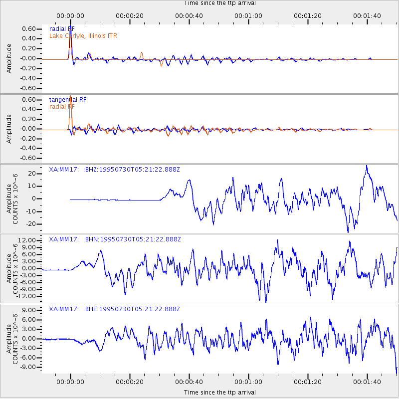
Signal To Noise
| Channel | StoN | STA | LTA |
| XA:MM17: :BHN:19950730T05:21:22.888Z | 18.129698 | 1.9745544E-6 | 1.0891271E-7 |
| XA:MM17: :BHE:19950730T05:21:22.888Z | 12.464635 | 8.2662274E-7 | 6.631745E-8 |
| XA:MM17: :BHZ:19950730T05:21:22.888Z | 26.747786 | 4.5591314E-6 | 1.7044891E-7 |
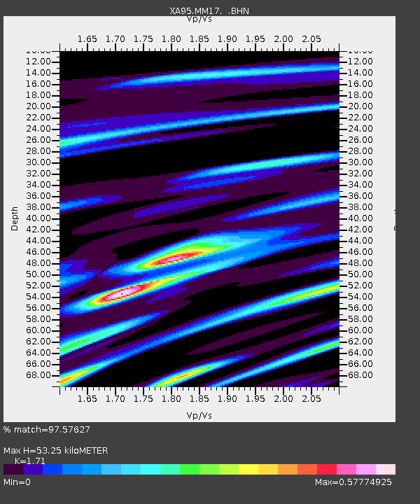
| Arrivals | |
| Ps | 6.1 SECOND |
| PpPs | 21 SECOND |
| PsPs/PpSs | 28 SECOND |

