
MO18 Tyson (bunker), Missouri - Earthquake Result Viewer
| ||||||||||||||||||
| ||||||||||||||||||
| ||||||||||||||||||
|
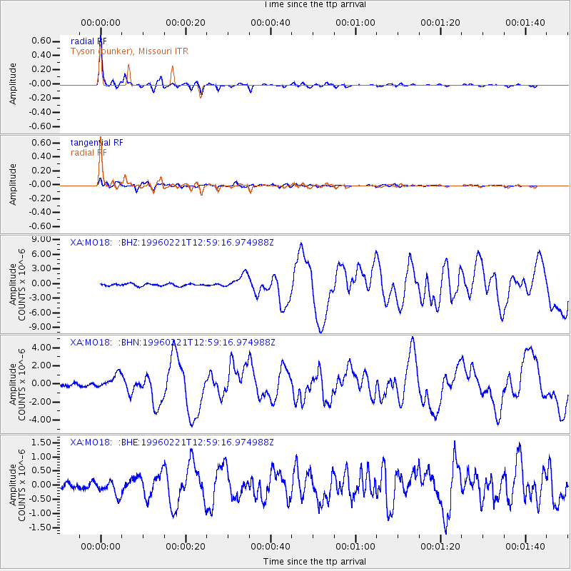
Signal To Noise
| Channel | StoN | STA | LTA |
| XA:MO18: :BHN:19960221T12:59:16.974988Z | 5.897134 | 8.616964E-7 | 1.4612121E-7 |
| XA:MO18: :BHE:19960221T12:59:16.974988Z | 2.3528683 | 2.6930795E-7 | 1.14459425E-7 |
| XA:MO18: :BHZ:19960221T12:59:16.974988Z | 6.8604307 | 1.5736138E-6 | 2.2937536E-7 |
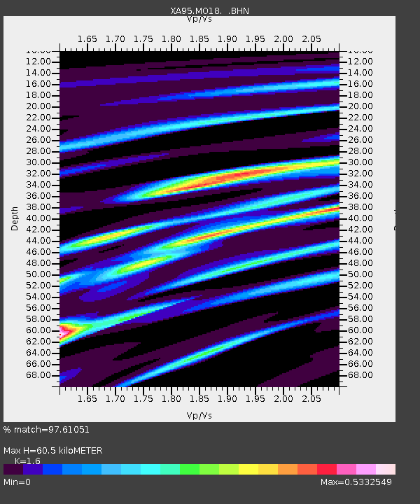
| Arrivals | |
| Ps | 6.0 SECOND |
| PpPs | 23 SECOND |
| PsPs/PpSs | 29 SECOND |

