MO18 Tyson (bunker), Missouri - Earthquake Result Viewer
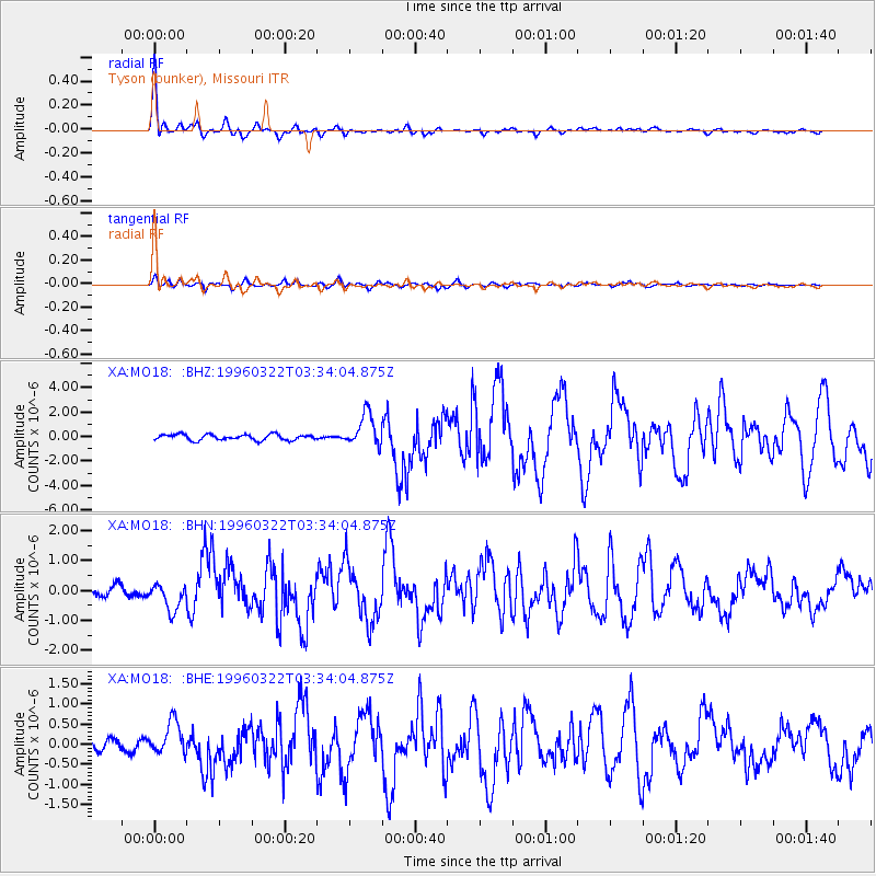
Earthquake location: Rat Islands, Aleutian Islands
Earthquake latitude/longitude: 51.2/178.7
Earthquake time(UTC): 1996/03/22 (082) 03:24:20 GMT
Earthquake Depth: 20 km
Earthquake Magnitude: 5.7 MB, 6.6 MS, 6.8 UNKNOWN, 6.6 ML
Earthquake Catalog/Contributor: WHDF/NEIC
Network: XA Missouri to Massachusetts Transect
Station: MO18 Tyson (bunker), Missouri
Lat/Lon: 38.51 N/90.56 W
Elevation: 161 m
Distance: 61.6 deg
Az: 63.105 deg
Baz: 314.363 deg
Ray Param: 0.060755897
Estimated Moho Depth: 27.0 km
Estimated Crust Vp/Vs: 1.76
Assumed Crust Vp: 6.498 km/s
Estimated Crust Vs: 3.687 km/s
Estimated Crust Poisson's Ratio: 0.26
Radial Match: 95.71428 %
Radial Bump: 378
Transverse Match: 75.276825 %
Transverse Bump: 400
SOD ConfigId: 6273
Insert Time: 2010-02-26 17:58:00.017 +0000
GWidth: 2.5
Max Bumps: 400
Tol: 0.001

Signal To Noise

ChannelStoNSTALTA
XA:MO18: :BHN:19960322T03:34:04.875Z2.54061994.3399538E-71.7082264E-7
XA:MO18: :BHE:19960322T03:34:04.875Z2.05791693.939978E-71.9145467E-7
XA:MO18: :BHZ:19960322T03:34:04.875Z5.7038441.313483E-62.3028032E-7
Arrivals
Ps3.3 SECOND
PpPs11 SECOND
PsPs/PpSs14 SECOND