You are here: Home > Network List > XA95 - Missouri to Massachusetts Transect Stations List
> Station MO18 Tyson (bunker), Missouri > Earthquake Result Viewer
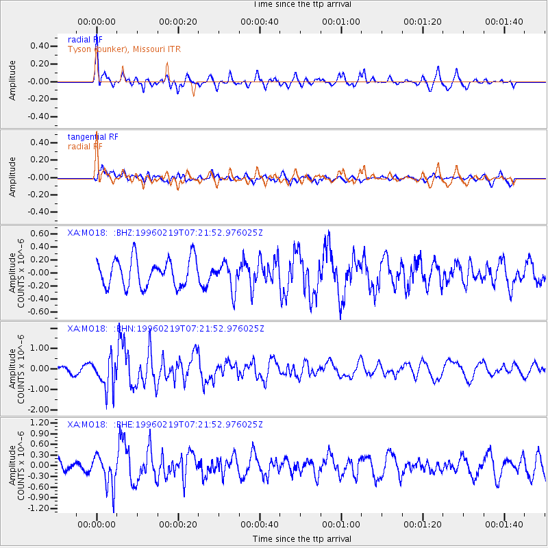
MO18 Tyson (bunker), Missouri - Earthquake Result Viewer
*The percent match for this event was below the threshold and hence no stack was calculated.
| Earthquake location: |
Off Coast Of Southern Chile |
| Earthquake latitude/longitude: |
-42.1/-75.1 |
| Earthquake time(UTC): |
1996/02/19 (050) 07:10:10 GMT |
| Earthquake Depth: |
33 km |
| Earthquake Magnitude: |
5.9 MB, 5.3 MS, 5.9 UNKNOWN, 5.9 MW |
| Earthquake Catalog/Contributor: |
WHDF/NEIC |
|
| Network: |
XA Missouri to Massachusetts Transect |
| Station: |
MO18 Tyson (bunker), Missouri |
| Lat/Lon: |
38.51 N/90.56 W |
| Elevation: |
161 m |
|
| Distance: |
81.5 deg |
| Az: |
347.777 deg |
| Baz: |
168.412 deg |
| Ray Param: |
$rayparam |
*The percent match for this event was below the threshold and hence was not used in the summary stack. |
|
| Radial Match: |
74.20838 % |
| Radial Bump: |
400 |
| Transverse Match: |
42.54309 % |
| Transverse Bump: |
400 |
| SOD ConfigId: |
4480 |
| Insert Time: |
2010-02-26 17:58:01.420 +0000 |
| GWidth: |
2.5 |
| Max Bumps: |
400 |
| Tol: |
0.001 |
|
Signal To Noise
| Channel | StoN | STA | LTA |
| XA:MO18: :BHN:19960219T07:21:52.976025Z | 3.3783236 | 7.68066E-7 | 2.2735122E-7 |
| XA:MO18: :BHE:19960219T07:21:52.976025Z | 2.7584405 | 4.5251142E-7 | 1.6404611E-7 |
| XA:MO18: :BHZ:19960219T07:21:52.976025Z | 1.0114111 | 2.1582295E-7 | 2.1338798E-7 |
| Arrivals |
| Ps | |
| PpPs | |
| PsPs/PpSs | |


