You are here: Home > Network List > IC - New China Digital Seismograph Network Stations List
> Station HIA Hailar, Neimenggu Autonomous Region, China > Earthquake Result Viewer
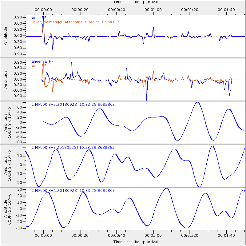
HIA Hailar, Neimenggu Autonomous Region, China - Earthquake Result Viewer
*The percent match for this event was below the threshold and hence no stack was calculated.
| Earthquake location: |
Sulawesi, Indonesia |
| Earthquake latitude/longitude: |
-1.1/120.0 |
| Earthquake time(UTC): |
2018/09/28 (271) 10:25:04 GMT |
| Earthquake Depth: |
10 km |
| Earthquake Magnitude: |
5.8 mb |
| Earthquake Catalog/Contributor: |
NEIC PDE/us |
|
| Network: |
IC New China Digital Seismograph Network |
| Station: |
HIA Hailar, Neimenggu Autonomous Region, China |
| Lat/Lon: |
49.27 N/119.74 E |
| Elevation: |
620 m |
|
| Distance: |
50.1 deg |
| Az: |
359.813 deg |
| Baz: |
179.714 deg |
| Ray Param: |
$rayparam |
*The percent match for this event was below the threshold and hence was not used in the summary stack. |
|
| Radial Match: |
79.499 % |
| Radial Bump: |
400 |
| Transverse Match: |
56.96691 % |
| Transverse Bump: |
255 |
| SOD ConfigId: |
3045211 |
| Insert Time: |
2018-10-12 10:25:49.525 +0000 |
| GWidth: |
2.5 |
| Max Bumps: |
400 |
| Tol: |
0.001 |
|
Signal To Noise
| Channel | StoN | STA | LTA |
| IC:HIA:00:BHZ:20180928T10:33:28.868986Z | 0.5341393 | 1.2541707E-5 | 2.348022E-5 |
| IC:HIA:00:BH1:20180928T10:33:28.868986Z | 1.073921 | 2.6287351E-5 | 2.4477918E-5 |
| IC:HIA:00:BH2:20180928T10:33:28.868986Z | 2.410669 | 5.759708E-5 | 2.389257E-5 |
| Arrivals |
| Ps | |
| PpPs | |
| PsPs/PpSs | |


