You are here: Home > Network List > IC - New China Digital Seismograph Network Stations List
> Station HIA Hailar, Neimenggu Province, China > Earthquake Result Viewer
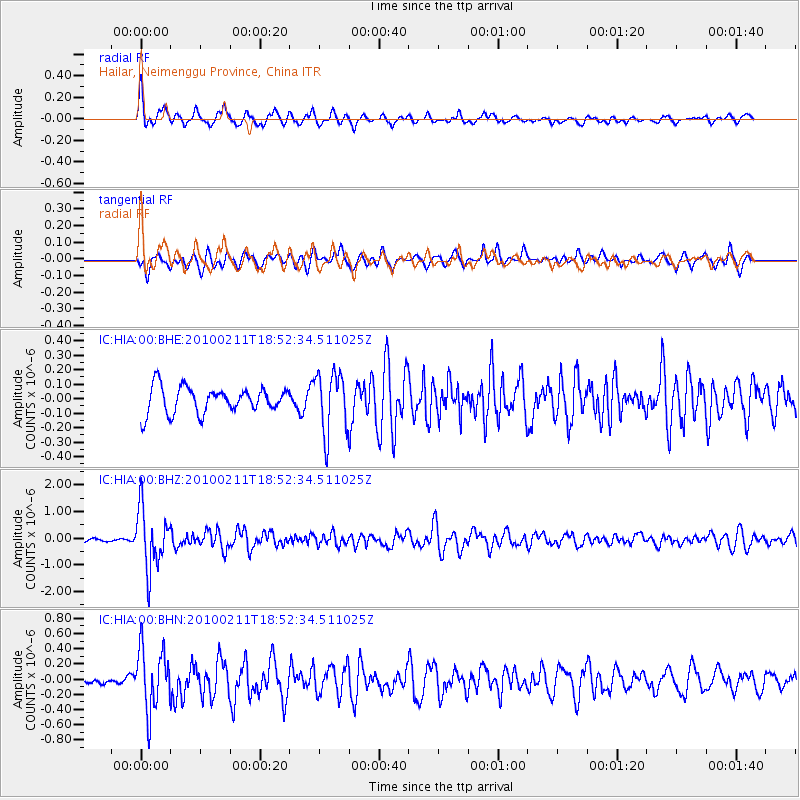
HIA Hailar, Neimenggu Province, China - Earthquake Result Viewer
*The percent match for this event was below the threshold and hence no stack was calculated.
| Earthquake location: |
South Of Java, Indonesia |
| Earthquake latitude/longitude: |
-9.9/113.8 |
| Earthquake time(UTC): |
2010/02/11 (042) 18:43:09 GMT |
| Earthquake Depth: |
51 km |
| Earthquake Magnitude: |
5.9 MB, 5.3 MS, 5.8 MW, 5.7 MW |
| Earthquake Catalog/Contributor: |
WHDF/NEIC |
|
| Network: |
IC New China Digital Seismograph Network |
| Station: |
HIA Hailar, Neimenggu Province, China |
| Lat/Lon: |
49.27 N/119.74 E |
| Elevation: |
610 m |
|
| Distance: |
59.1 deg |
| Az: |
4.496 deg |
| Baz: |
186.772 deg |
| Ray Param: |
$rayparam |
*The percent match for this event was below the threshold and hence was not used in the summary stack. |
|
| Radial Match: |
72.69493 % |
| Radial Bump: |
397 |
| Transverse Match: |
65.11991 % |
| Transverse Bump: |
400 |
| SOD ConfigId: |
305946 |
| Insert Time: |
2010-05-04 06:46:18.354 +0000 |
| GWidth: |
2.5 |
| Max Bumps: |
400 |
| Tol: |
0.001 |
|
Signal To Noise
| Channel | StoN | STA | LTA |
| IC:HIA:00:BHZ:20100211T18:52:34.511025Z | 9.363508 | 1.1146096E-6 | 1.1903761E-7 |
| IC:HIA:00:BHN:20100211T18:52:34.511025Z | 5.813701 | 4.1240224E-7 | 7.093626E-8 |
| IC:HIA:00:BHE:20100211T18:52:34.511025Z | 2.3338618 | 2.0949406E-7 | 8.976284E-8 |
| Arrivals |
| Ps | |
| PpPs | |
| PsPs/PpSs | |


