SA30 XA.SA30 - Earthquake Result Viewer
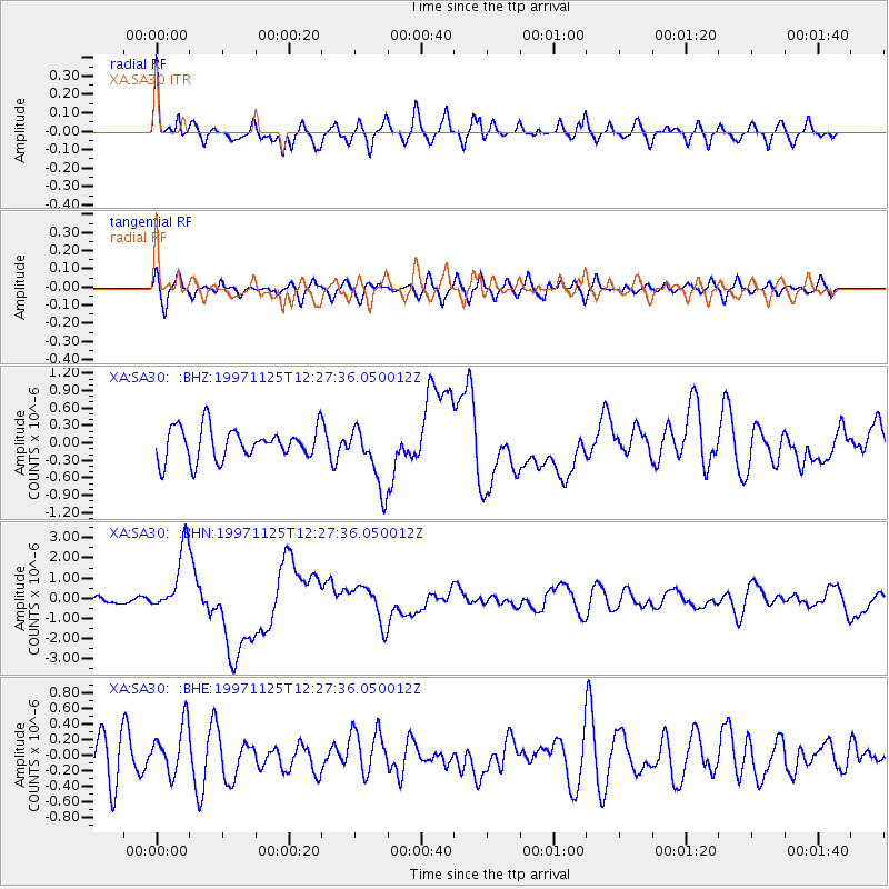
Earthquake location: Minahassa Peninsula, Sulawesi
Earthquake latitude/longitude: 1.2/122.5
Earthquake time(UTC): 1997/11/25 (329) 12:14:33 GMT
Earthquake Depth: 24 km
Earthquake Magnitude: 6.1 MB, 6.8 MS, 7.1 UNKNOWN, 6.7 ME
Earthquake Catalog/Contributor: WHDF/NEIC
Network: XA Anatomy of an Archean Craton, South Africa
Station: SA30 XA.SA30
Lat/Lon: 27.07 S/24.17 E
Elevation: 1361 m
Distance: 98.0 deg
Az: 242.985 deg
Baz: 92.703 deg
Ray Param: 0.04002434
Estimated Moho Depth: 31.5 km
Estimated Crust Vp/Vs: 2.10
Assumed Crust Vp: 6.459 km/s
Estimated Crust Vs: 3.08 km/s
Estimated Crust Poisson's Ratio: 0.35
Radial Match: 83.149704 %
Radial Bump: 400
Transverse Match: 51.44405 %
Transverse Bump: 400
SOD ConfigId: 4480
Insert Time: 2010-02-26 18:09:16.968 +0000
GWidth: 2.5
Max Bumps: 400
Tol: 0.001

Signal To Noise

ChannelStoNSTALTA
XA:SA30: :BHN:19971125T12:27:36.050012Z12.37610151.6326001E-61.3191553E-7
XA:SA30: :BHE:19971125T12:27:36.050012Z1.13081013.1848867E-72.816465E-7
XA:SA30: :BHZ:19971125T12:27:36.050012Z1.95676335.379107E-72.7489818E-7
Arrivals
Ps5.4 SECOND
PpPs15 SECOND
PsPs/PpSs20 SECOND