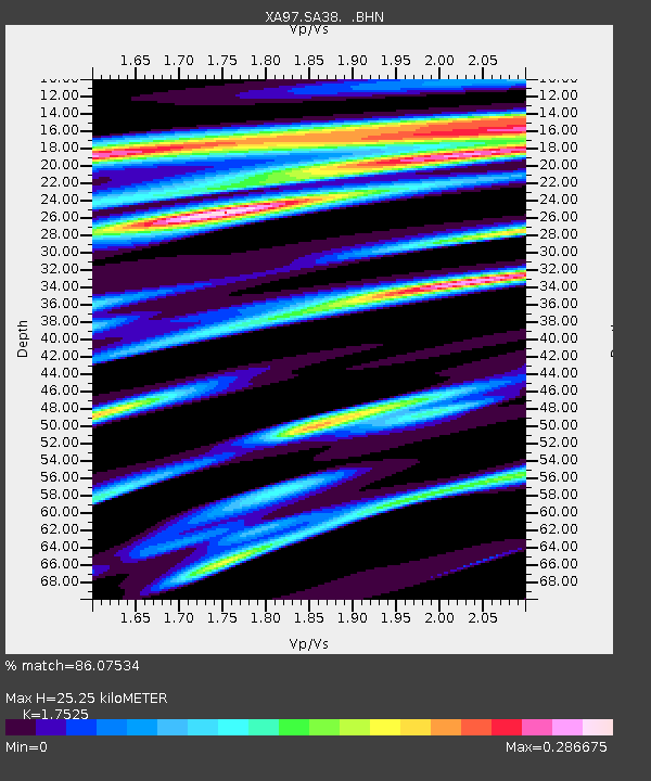
SA38 XA.SA38 - Earthquake Result Viewer
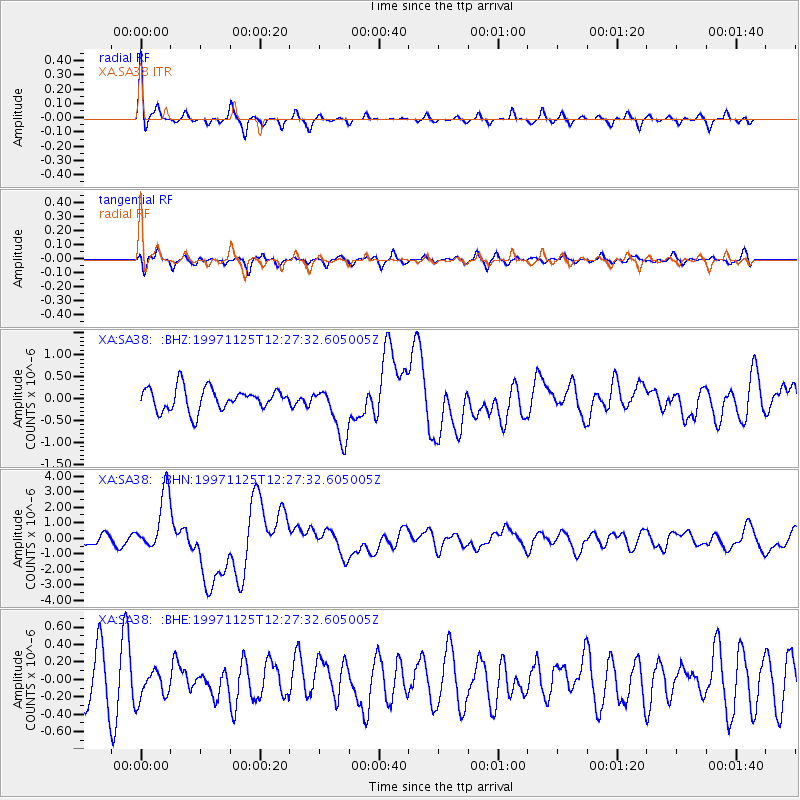
Earthquake location: Minahassa Peninsula, Sulawesi
Earthquake latitude/longitude: 1.2/122.5
Earthquake time(UTC): 1997/11/25 (329) 12:14:33 GMT
Earthquake Depth: 24 km
Earthquake Magnitude: 6.1 MB, 6.8 MS, 7.1 UNKNOWN, 6.7 ME
Earthquake Catalog/Contributor: WHDF/NEIC
Network: XA Anatomy of an Archean Craton, South Africa
Station: SA38 XA.SA38
Lat/Lon: 25.93 S/25.08 E
Elevation: 1219 m
Distance: 97.2 deg
Az: 244.163 deg
Baz: 92.139 deg
Ray Param: 0.040263068
Estimated Moho Depth: 25.25 km
Estimated Crust Vp/Vs: 1.75
Assumed Crust Vp: 6.459 km/s
Estimated Crust Vs: 3.686 km/s
Estimated Crust Poisson's Ratio: 0.26
Radial Match: 86.07534 %
Radial Bump: 272
Transverse Match: 55.15397 %
Transverse Bump: 400
SOD ConfigId: 4480
Insert Time: 2010-02-26 18:12:52.975 +0000
GWidth: 2.5
Max Bumps: 400
Tol: 0.001

Signal To Noise

ChannelStoNSTALTA
XA:SA38: :BHN:19971125T12:27:32.605005Z6.62400151.9175347E-62.8948284E-7
XA:SA38: :BHE:19971125T12:27:32.605005Z0.662622031.6740208E-72.5263586E-7
XA:SA38: :BHZ:19971125T12:27:32.605005Z2.3974586.1024235E-72.5453724E-7
Arrivals
Ps3.0 SECOND
PpPs11 SECOND
PsPs/PpSs14 SECOND