
SA39 XA.SA39 - Earthquake Result Viewer
| ||||||||||||||||||
| ||||||||||||||||||
| ||||||||||||||||||
|
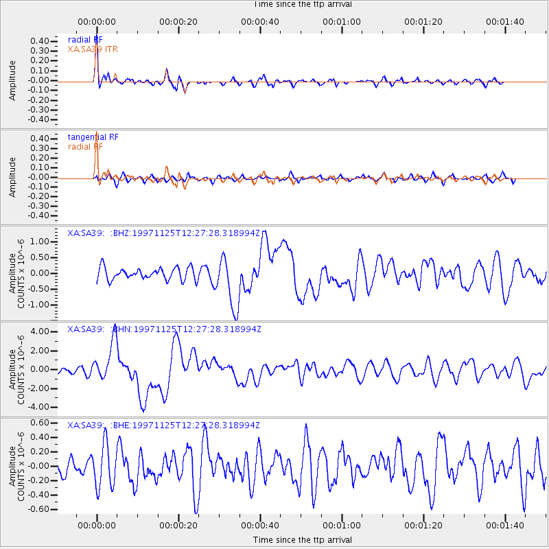
Signal To Noise
| Channel | StoN | STA | LTA |
| XA:SA39: :BHN:19971125T12:27:28.318994Z | 10.964497 | 2.2028364E-6 | 2.009063E-7 |
| XA:SA39: :BHE:19971125T12:27:28.318994Z | 1.282117 | 3.0627365E-7 | 2.388812E-7 |
| XA:SA39: :BHZ:19971125T12:27:28.318994Z | 4.4558024 | 8.37791E-7 | 1.8802248E-7 |
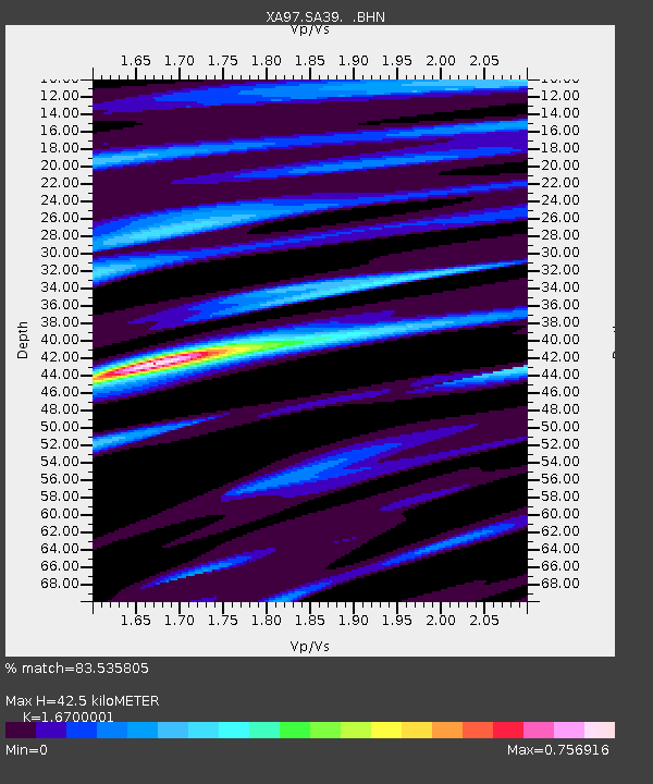
| Arrivals | |
| Ps | 4.5 SECOND |
| PpPs | 17 SECOND |
| PsPs/PpSs | 22 SECOND |

