You are here: Home > Network List > TA - USArray Transportable Network (new EarthScope stations) Stations List
> Station W37A Quinton, OK, USA > Earthquake Result Viewer
W37A Quinton, OK, USA - Earthquake Result Viewer
*The percent match for this event was below the threshold and hence no stack was calculated.
| Earthquake location: |
Kuril Islands |
| Earthquake latitude/longitude: |
46.3/152.0 |
| Earthquake time(UTC): |
2010/05/17 (137) 22:03:47 GMT |
| Earthquake Depth: |
73 km |
| Earthquake Magnitude: |
5.7 MB, 5.3 MW |
| Earthquake Catalog/Contributor: |
WHDF/NEIC |
|
| Network: |
TA USArray Transportable Network (new EarthScope stations) |
| Station: |
W37A Quinton, OK, USA |
| Lat/Lon: |
35.14 N/95.43 W |
| Elevation: |
281 m |
|
| Distance: |
78.8 deg |
| Az: |
50.503 deg |
| Baz: |
319.24 deg |
| Ray Param: |
$rayparam |
*The percent match for this event was below the threshold and hence was not used in the summary stack. |
|
| Radial Match: |
35.572605 % |
| Radial Bump: |
354 |
| Transverse Match: |
65.0998 % |
| Transverse Bump: |
400 |
| SOD ConfigId: |
314592 |
| Insert Time: |
2010-09-04 07:06:24.007 +0000 |
| GWidth: |
2.5 |
| Max Bumps: |
400 |
| Tol: |
0.001 |
|
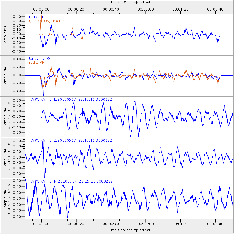
Signal To Noise
| Channel | StoN | STA | LTA |
| TA:W37A: :BHZ:20100517T22:15:11.300022Z | 1.9247787 | 5.1572067E-7 | 2.6793765E-7 |
| TA:W37A: :BHN:20100517T22:15:11.300022Z | 1.0968155 | 2.8520296E-7 | 2.600282E-7 |
| TA:W37A: :BHE:20100517T22:15:11.300022Z | 0.9855944 | 2.1130512E-7 | 2.143936E-7 |
| Arrivals |
| Ps | |
| PpPs | |
| PsPs/PpSs | |


