SA47 XA.SA47 - Earthquake Result Viewer
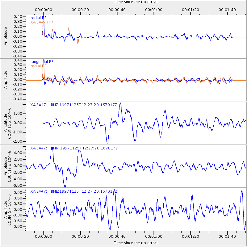
Earthquake location: Minahassa Peninsula, Sulawesi
Earthquake latitude/longitude: 1.2/122.5
Earthquake time(UTC): 1997/11/25 (329) 12:14:33 GMT
Earthquake Depth: 24 km
Earthquake Magnitude: 6.1 MB, 6.8 MS, 7.1 UNKNOWN, 6.7 ME
Earthquake Catalog/Contributor: WHDF/NEIC
Network: XA Anatomy of an Archean Craton, South Africa
Station: SA47 XA.SA47
Lat/Lon: 24.85 S/28.16 E
Elevation: 1153 m
Distance: 94.5 deg
Az: 245.319 deg
Baz: 90.708 deg
Ray Param: 0.041024063
Estimated Moho Depth: 65.5 km
Estimated Crust Vp/Vs: 1.61
Assumed Crust Vp: 6.459 km/s
Estimated Crust Vs: 4.025 km/s
Estimated Crust Poisson's Ratio: 0.18
Radial Match: 83.78259 %
Radial Bump: 249
Transverse Match: 66.46084 %
Transverse Bump: 400
SOD ConfigId: 4480
Insert Time: 2010-02-26 18:16:44.673 +0000
GWidth: 2.5
Max Bumps: 400
Tol: 0.001

Signal To Noise

ChannelStoNSTALTA
XA:SA47: :BHN:19971125T12:27:20.167017Z7.11263042.4168055E-63.3979066E-7
XA:SA47: :BHE:19971125T12:27:20.167017Z0.76417061.712147E-72.2405297E-7
XA:SA47: :BHZ:19971125T12:27:20.167017Z3.33217368.242398E-72.47358E-7
Arrivals
Ps6.3 SECOND
PpPs26 SECOND
PsPs/PpSs32 SECOND