
BJI Baijiatuan, Beijing, China - Earthquake Result Viewer
| ||||||||||||||||||
| ||||||||||||||||||
| ||||||||||||||||||
|
Signal To Noise
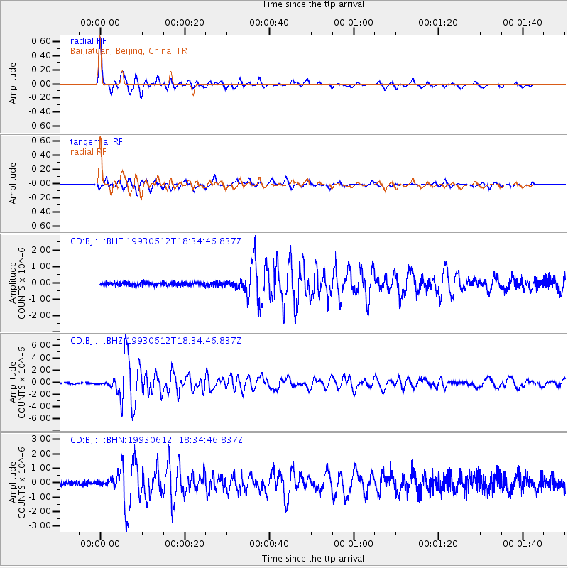
| Channel | StoN | STA | LTA |
| CD:BJI: :BHZ:19930612T18:34:46.837Z | 9.082223 | 8.1744076E-7 | 9.0004484E-8 |
| CD:BJI: :BHN:19930612T18:34:46.837Z | 2.6894073 | 3.2217133E-7 | 1.1979269E-7 |
| CD:BJI: :BHE:19930612T18:34:46.837Z | 2.5091512 | 2.306109E-7 | 9.190793E-8 |
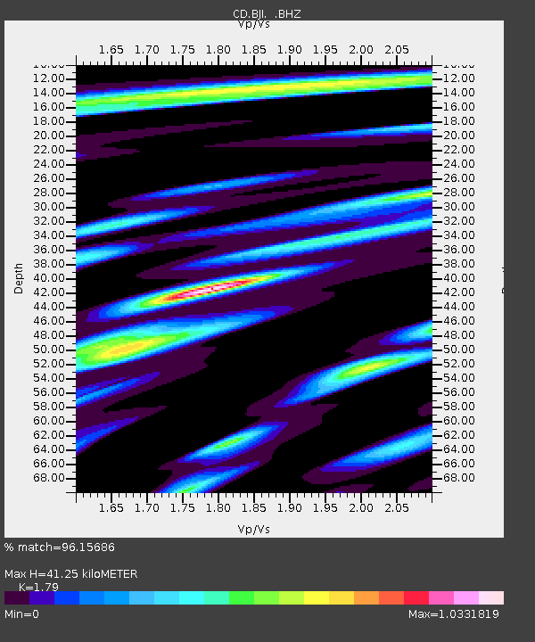
| Arrivals | |
| Ps | 5.4 SECOND |
| PpPs | 17 SECOND |
| PsPs/PpSs | 22 SECOND |

