
BJI Baijiatuan, Beijing, China - Earthquake Result Viewer
| ||||||||||||||||||
| ||||||||||||||||||
| ||||||||||||||||||
|
Signal To Noise
| Channel | StoN | STA | LTA |
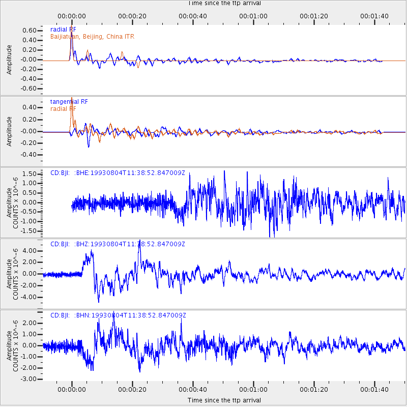
| CD:BJI: :BHZ:19930804T11:38:52.847009Z | 6.3351583 | 1.1329416E-6 | 1.7883399E-7 |
| CD:BJI: :BHN:19930804T11:38:52.847009Z | 2.039571 | 5.651574E-7 | 2.770962E-7 |
| CD:BJI: :BHE:19930804T11:38:52.847009Z | 1.5805534 | 3.390486E-7 | 2.1451257E-7 |
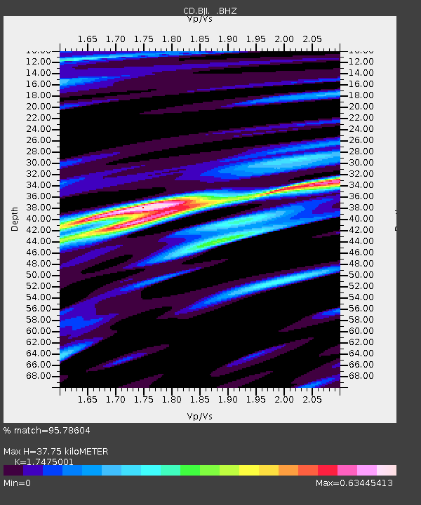
| Arrivals | |
| Ps | 4.7 SECOND |
| PpPs | 15 SECOND |
| PsPs/PpSs | 20 SECOND |

