You are here: Home > Network List > IC - New China Digital Seismograph Network Stations List
> Station HIA Hailar, Neimenggu Autonomous Region, China > Earthquake Result Viewer
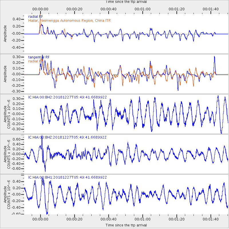
HIA Hailar, Neimenggu Autonomous Region, China - Earthquake Result Viewer
*The percent match for this event was below the threshold and hence no stack was calculated.
| Earthquake location: |
Solomon Islands |
| Earthquake latitude/longitude: |
-10.1/161.1 |
| Earthquake time(UTC): |
2018/12/27 (361) 05:39:12 GMT |
| Earthquake Depth: |
71 km |
| Earthquake Magnitude: |
5.4 Mww |
| Earthquake Catalog/Contributor: |
NEIC PDE/us |
|
| Network: |
IC New China Digital Seismograph Network |
| Station: |
HIA Hailar, Neimenggu Autonomous Region, China |
| Lat/Lon: |
49.27 N/119.74 E |
| Elevation: |
620 m |
|
| Distance: |
69.4 deg |
| Az: |
332.426 deg |
| Baz: |
135.897 deg |
| Ray Param: |
$rayparam |
*The percent match for this event was below the threshold and hence was not used in the summary stack. |
|
| Radial Match: |
45.83714 % |
| Radial Bump: |
384 |
| Transverse Match: |
59.649857 % |
| Transverse Bump: |
338 |
| SOD ConfigId: |
3201911 |
| Insert Time: |
2019-01-10 05:55:04.489 +0000 |
| GWidth: |
2.5 |
| Max Bumps: |
400 |
| Tol: |
0.001 |
|
Signal To Noise
| Channel | StoN | STA | LTA |
| IC:HIA:00:BHZ:20181227T05:49:41.668992Z | 2.4853384 | 3.5541422E-7 | 1.4300436E-7 |
| IC:HIA:00:BH1:20181227T05:49:41.668992Z | 2.107513 | 3.6135603E-7 | 1.7146088E-7 |
| IC:HIA:00:BH2:20181227T05:49:41.668992Z | 1.2136438 | 1.297647E-7 | 1.0692157E-7 |
| Arrivals |
| Ps | |
| PpPs | |
| PsPs/PpSs | |


