SA66 XA.SA66 - Earthquake Result Viewer
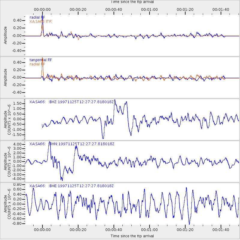
Earthquake location: Minahassa Peninsula, Sulawesi
Earthquake latitude/longitude: 1.2/122.5
Earthquake time(UTC): 1997/11/25 (329) 12:14:33 GMT
Earthquake Depth: 24 km
Earthquake Magnitude: 6.1 MB, 6.8 MS, 7.1 UNKNOWN, 6.7 ME
Earthquake Catalog/Contributor: WHDF/NEIC
Network: XA Anatomy of an Archean Craton, South Africa
Station: SA66 XA.SA66
Lat/Lon: 21.90 S/26.37 E
Elevation: 1057 m
Distance: 96.2 deg
Az: 248.237 deg
Baz: 91.143 deg
Ray Param: 0.040576708
Estimated Moho Depth: 27.25 km
Estimated Crust Vp/Vs: 1.63
Assumed Crust Vp: 6.459 km/s
Estimated Crust Vs: 3.969 km/s
Estimated Crust Poisson's Ratio: 0.20
Radial Match: 85.898994 %
Radial Bump: 400
Transverse Match: 49.827797 %
Transverse Bump: 400
SOD ConfigId: 4480
Insert Time: 2010-02-26 18:27:51.021 +0000
GWidth: 2.5
Max Bumps: 400
Tol: 0.001

Signal To Noise

ChannelStoNSTALTA
XA:SA66: :BHN:19971125T12:27:27.818018Z5.68451832.101373E-63.6966597E-7
XA:SA66: :BHE:19971125T12:27:27.818018Z0.62919292.0082986E-73.1918648E-7
XA:SA66: :BHZ:19971125T12:27:27.818018Z2.75265177.307201E-72.6546044E-7
Arrivals
Ps2.7 SECOND
PpPs11 SECOND
PsPs/PpSs14 SECOND