SA67 XA.SA67 - Earthquake Result Viewer
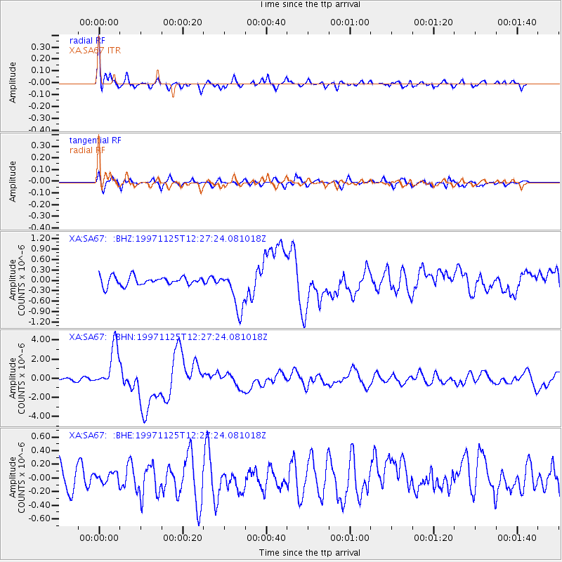
Earthquake location: Minahassa Peninsula, Sulawesi
Earthquake latitude/longitude: 1.2/122.5
Earthquake time(UTC): 1997/11/25 (329) 12:14:33 GMT
Earthquake Depth: 24 km
Earthquake Magnitude: 6.1 MB, 6.8 MS, 7.1 UNKNOWN, 6.7 ME
Earthquake Catalog/Contributor: WHDF/NEIC
Network: XA Anatomy of an Archean Craton, South Africa
Station: SA67 XA.SA67
Lat/Lon: 21.89 S/27.27 E
Elevation: 913 m
Distance: 95.3 deg
Az: 248.266 deg
Baz: 90.806 deg
Ray Param: 0.04079875
Estimated Moho Depth: 14.0 km
Estimated Crust Vp/Vs: 2.10
Assumed Crust Vp: 6.459 km/s
Estimated Crust Vs: 3.08 km/s
Estimated Crust Poisson's Ratio: 0.35
Radial Match: 88.752205 %
Radial Bump: 400
Transverse Match: 71.62078 %
Transverse Bump: 400
SOD ConfigId: 4480
Insert Time: 2010-02-26 18:28:26.574 +0000
GWidth: 2.5
Max Bumps: 400
Tol: 0.001

Signal To Noise

ChannelStoNSTALTA
XA:SA67: :BHN:19971125T12:27:24.081018Z7.06524042.267973E-63.210044E-7
XA:SA67: :BHE:19971125T12:27:24.081018Z0.40313727.3438294E-81.8216699E-7
XA:SA67: :BHZ:19971125T12:27:24.081018Z4.68934355.974127E-71.2739793E-7
Arrivals
Ps2.4 SECOND
PpPs6.6 SECOND
PsPs/PpSs9.0 SECOND