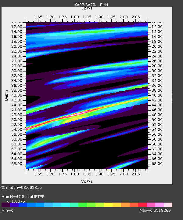
SA70 XA.SA70 - Earthquake Result Viewer
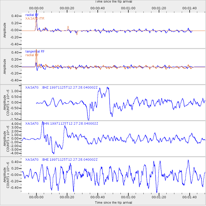
Earthquake location: Minahassa Peninsula, Sulawesi
Earthquake latitude/longitude: 1.2/122.5
Earthquake time(UTC): 1997/11/25 (329) 12:14:33 GMT
Earthquake Depth: 24 km
Earthquake Magnitude: 6.1 MB, 6.8 MS, 7.1 UNKNOWN, 6.7 ME
Earthquake Catalog/Contributor: WHDF/NEIC
Network: XA Anatomy of an Archean Craton, South Africa
Station: SA70 XA.SA70
Lat/Lon: 21.09 S/26.34 E
Elevation: 990 m
Distance: 96.2 deg
Az: 249.049 deg
Baz: 91.069 deg
Ray Param: 0.040563278
Estimated Moho Depth: 47.5 km
Estimated Crust Vp/Vs: 1.81
Assumed Crust Vp: 6.459 km/s
Estimated Crust Vs: 3.574 km/s
Estimated Crust Poisson's Ratio: 0.28
Radial Match: 93.662315 %
Radial Bump: 293
Transverse Match: 76.2496 %
Transverse Bump: 400
SOD ConfigId: 4480
Insert Time: 2010-02-26 18:29:32.795 +0000
GWidth: 2.5
Max Bumps: 400
Tol: 0.001

Signal To Noise

ChannelStoNSTALTA
XA:SA70: :BHN:19971125T12:27:28.040002Z7.08129552.0903433E-62.951922E-7
XA:SA70: :BHE:19971125T12:27:28.040002Z1.59465661.7058301E-71.0697162E-7
XA:SA70: :BHZ:19971125T12:27:28.040002Z4.3725027.161571E-71.6378657E-7
Arrivals
Ps6.1 SECOND
PpPs20 SECOND
PsPs/PpSs26 SECOND