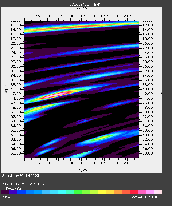
SA71 XA.SA71 - Earthquake Result Viewer
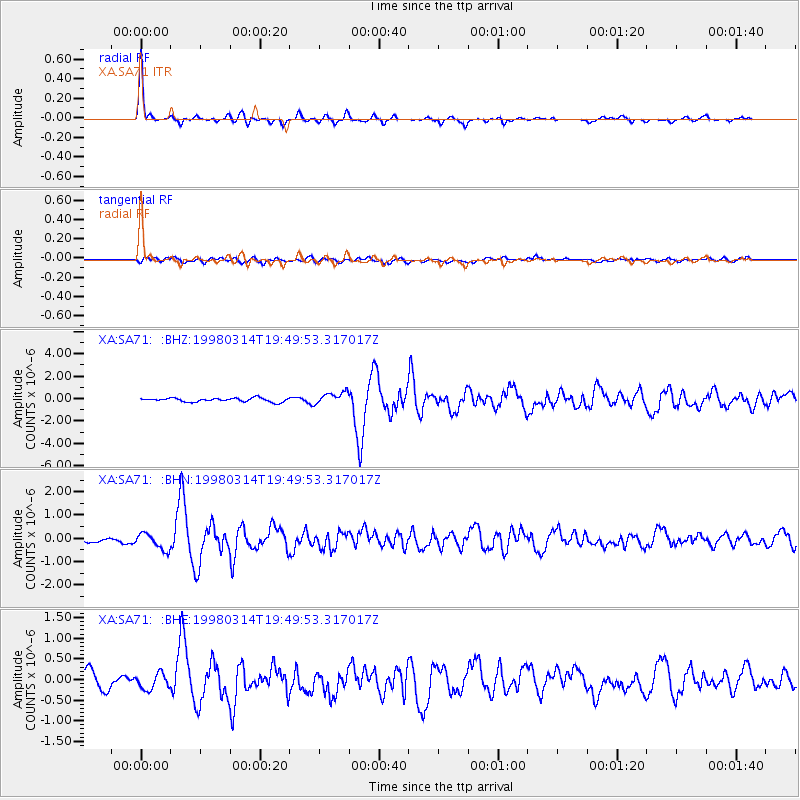
Earthquake location: Northern And Central Iran
Earthquake latitude/longitude: 30.2/57.6
Earthquake time(UTC): 1998/03/14 (073) 19:40:27 GMT
Earthquake Depth: 9.0 km
Earthquake Magnitude: 5.9 MB, 6.9 MS, 6.6 UNKNOWN, 6.3 ME
Earthquake Catalog/Contributor: WHDF/NEIC
Network: XA Anatomy of an Archean Craton, South Africa
Station: SA71 XA.SA71
Lat/Lon: 20.93 S/27.14 E
Elevation: 1072 m
Distance: 58.6 deg
Az: 213.715 deg
Baz: 30.949 deg
Ray Param: 0.062716745
Estimated Moho Depth: 42.25 km
Estimated Crust Vp/Vs: 1.74
Assumed Crust Vp: 6.459 km/s
Estimated Crust Vs: 3.723 km/s
Estimated Crust Poisson's Ratio: 0.25
Radial Match: 91.144905 %
Radial Bump: 269
Transverse Match: 51.837074 %
Transverse Bump: 400
SOD ConfigId: 6273
Insert Time: 2010-02-26 18:30:00.704 +0000
GWidth: 2.5
Max Bumps: 400
Tol: 0.001

Signal To Noise

ChannelStoNSTALTA
XA:SA71: :BHN:19980314T19:49:53.317017Z3.61217953.4785836E-79.630152E-8
XA:SA71: :BHE:19980314T19:49:53.317017Z0.680300831.9163508E-72.8169168E-7
XA:SA71: :BHZ:19980314T19:49:53.317017Z3.1511295.379566E-71.707187E-7
Arrivals
Ps5.1 SECOND
PpPs17 SECOND
PsPs/PpSs22 SECOND