SA73 XA.SA73 - Earthquake Result Viewer
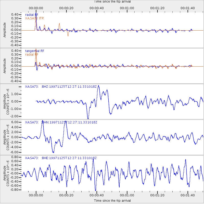
Earthquake location: Minahassa Peninsula, Sulawesi
Earthquake latitude/longitude: 1.2/122.5
Earthquake time(UTC): 1997/11/25 (329) 12:14:33 GMT
Earthquake Depth: 24 km
Earthquake Magnitude: 6.1 MB, 6.8 MS, 7.1 UNKNOWN, 6.7 ME
Earthquake Catalog/Contributor: WHDF/NEIC
Network: XA Anatomy of an Archean Craton, South Africa
Station: SA73 XA.SA73
Lat/Lon: 21.85 S/30.28 E
Elevation: 590 m
Distance: 92.6 deg
Az: 248.31 deg
Baz: 89.69 deg
Ray Param: 0.041429106
Estimated Moho Depth: 20.25 km
Estimated Crust Vp/Vs: 1.77
Assumed Crust Vp: 6.642 km/s
Estimated Crust Vs: 3.742 km/s
Estimated Crust Poisson's Ratio: 0.27
Radial Match: 93.274445 %
Radial Bump: 272
Transverse Match: 67.116554 %
Transverse Bump: 400
SOD ConfigId: 4480
Insert Time: 2010-02-26 18:31:03.048 +0000
GWidth: 2.5
Max Bumps: 400
Tol: 0.001

Signal To Noise

ChannelStoNSTALTA
XA:SA73: :BHN:19971125T12:27:11.331018Z15.3734943.0578499E-61.9890402E-7
XA:SA73: :BHE:19971125T12:27:11.331018Z1.33640251.884779E-71.4103377E-7
XA:SA73: :BHZ:19971125T12:27:11.331018Z8.9499411.0189095E-61.13845395E-7
Arrivals
Ps2.4 SECOND
PpPs8.3 SECOND
PsPs/PpSs11 SECOND