SA76 XA.SA76 - Earthquake Result Viewer
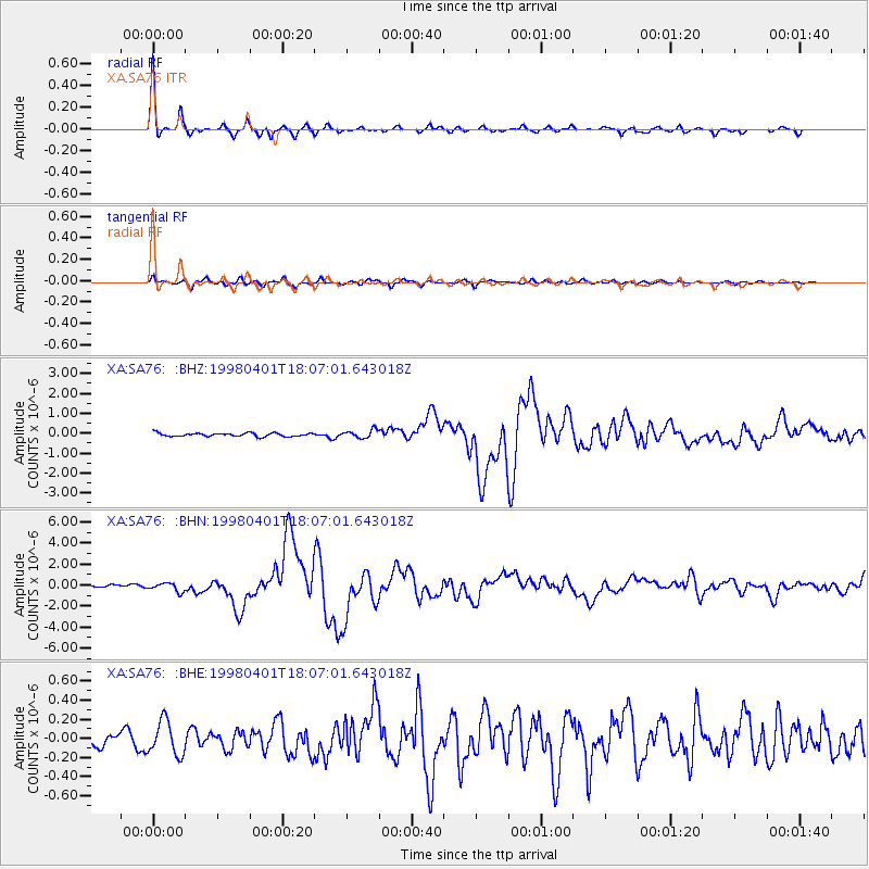
Earthquake location: Southern Sumatra, Indonesia
Earthquake latitude/longitude: -0.5/99.3
Earthquake time(UTC): 1998/04/01 (091) 17:56:23 GMT
Earthquake Depth: 56 km
Earthquake Magnitude: 6.2 MB, 6.9 MS, 7.0 UNKNOWN, 6.6 ME
Earthquake Catalog/Contributor: WHDF/NEIC
Network: XA Anatomy of an Archean Craton, South Africa
Station: SA76 XA.SA76
Lat/Lon: 20.64 S/29.85 E
Elevation: 978 m
Distance: 70.6 deg
Az: 248.395 deg
Baz: 83.036 deg
Ray Param: 0.0547766
Estimated Moho Depth: 35.75 km
Estimated Crust Vp/Vs: 1.76
Assumed Crust Vp: 6.459 km/s
Estimated Crust Vs: 3.675 km/s
Estimated Crust Poisson's Ratio: 0.26
Radial Match: 97.531876 %
Radial Bump: 247
Transverse Match: 81.42098 %
Transverse Bump: 397
SOD ConfigId: 4480
Insert Time: 2010-02-26 18:31:48.945 +0000
GWidth: 2.5
Max Bumps: 400
Tol: 0.001

Signal To Noise

ChannelStoNSTALTA
XA:SA76: :BHN:19980401T18:07:01.643018Z3.33691074.2106478E-71.26184E-7
XA:SA76: :BHE:19980401T18:07:01.643018Z1.9776451.7779305E-78.99014E-8
XA:SA76: :BHZ:19980401T18:07:01.643018Z2.32332872.018013E-78.68587E-8
Arrivals
Ps4.4 SECOND
PpPs15 SECOND
PsPs/PpSs19 SECOND