
SA76 XA.SA76 - Earthquake Result Viewer
| ||||||||||||||||||
| ||||||||||||||||||
| ||||||||||||||||||
|
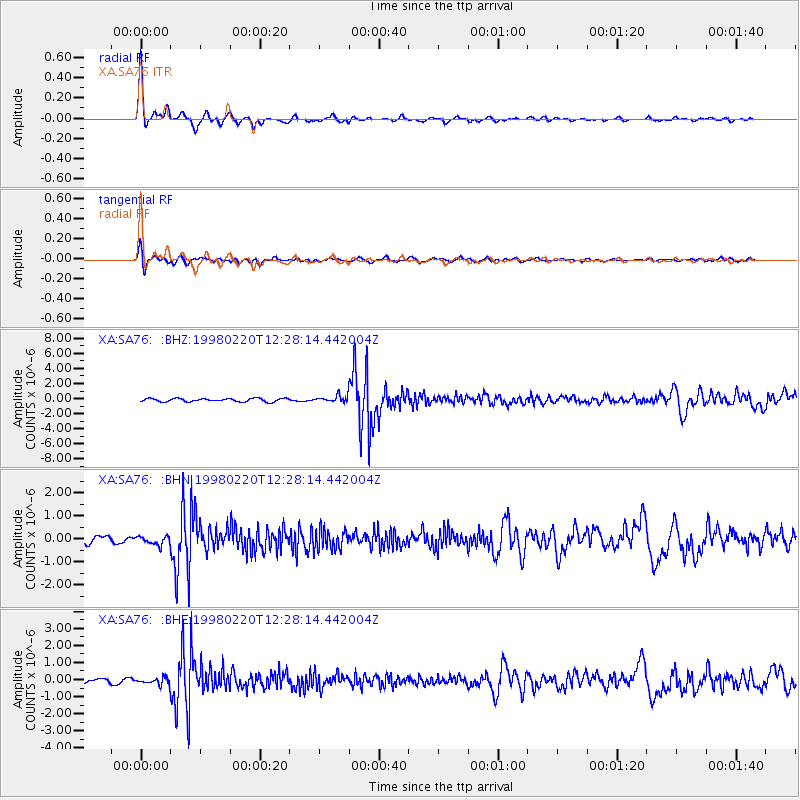
Signal To Noise
| Channel | StoN | STA | LTA |
| XA:SA76: :BHN:19980220T12:28:14.442004Z | 1.4294775 | 1.861625E-7 | 1.3023116E-7 |
| XA:SA76: :BHE:19980220T12:28:14.442004Z | 2.379466 | 1.8651735E-7 | 7.8386215E-8 |
| XA:SA76: :BHZ:19980220T12:28:14.442004Z | 1.9396989 | 4.1165782E-7 | 2.1222769E-7 |
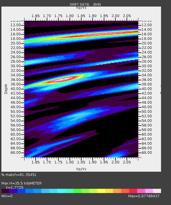
| Arrivals | |
| Ps | 4.4 SECOND |
| PpPs | 15 SECOND |
| PsPs/PpSs | 19 SECOND |

