SA77 XA.SA77 - Earthquake Result Viewer
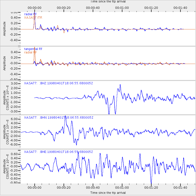
Earthquake location: Southern Sumatra, Indonesia
Earthquake latitude/longitude: -0.5/99.3
Earthquake time(UTC): 1998/04/01 (091) 17:56:23 GMT
Earthquake Depth: 56 km
Earthquake Magnitude: 6.2 MB, 6.9 MS, 7.0 UNKNOWN, 6.6 ME
Earthquake Catalog/Contributor: WHDF/NEIC
Network: XA Anatomy of an Archean Craton, South Africa
Station: SA77 XA.SA77
Lat/Lon: 20.76 S/30.92 E
Elevation: 576 m
Distance: 69.6 deg
Az: 248.136 deg
Baz: 82.57 deg
Ray Param: 0.055426113
Estimated Moho Depth: 33.75 km
Estimated Crust Vp/Vs: 1.81
Assumed Crust Vp: 6.642 km/s
Estimated Crust Vs: 3.67 km/s
Estimated Crust Poisson's Ratio: 0.28
Radial Match: 97.05804 %
Radial Bump: 269
Transverse Match: 86.38651 %
Transverse Bump: 400
SOD ConfigId: 4480
Insert Time: 2010-02-26 18:32:34.458 +0000
GWidth: 2.5
Max Bumps: 400
Tol: 0.001

Signal To Noise

ChannelStoNSTALTA
XA:SA77: :BHN:19980401T18:06:55.680005Z1.8447433.7134245E-72.0129765E-7
XA:SA77: :BHE:19980401T18:06:55.680005Z0.8808728.336976E-89.4644584E-8
XA:SA77: :BHZ:19980401T18:06:55.680005Z2.1876762.2737778E-71.03935776E-7
Arrivals
Ps4.3 SECOND
PpPs14 SECOND
PsPs/PpSs18 SECOND