SA77 XA.SA77 - Earthquake Result Viewer
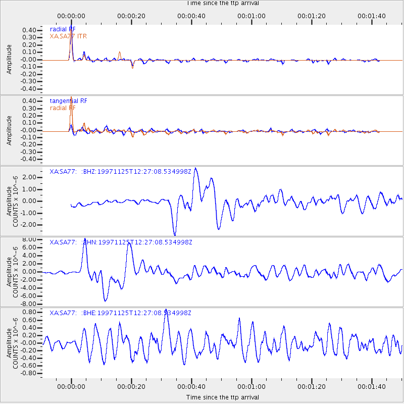
Earthquake location: Minahassa Peninsula, Sulawesi
Earthquake latitude/longitude: 1.2/122.5
Earthquake time(UTC): 1997/11/25 (329) 12:14:33 GMT
Earthquake Depth: 24 km
Earthquake Magnitude: 6.1 MB, 6.8 MS, 7.1 UNKNOWN, 6.7 ME
Earthquake Catalog/Contributor: WHDF/NEIC
Network: XA Anatomy of an Archean Craton, South Africa
Station: SA77 XA.SA77
Lat/Lon: 20.76 S/30.92 E
Elevation: 576 m
Distance: 91.9 deg
Az: 249.399 deg
Baz: 89.416 deg
Ray Param: 0.04152761
Estimated Moho Depth: 41.25 km
Estimated Crust Vp/Vs: 1.69
Assumed Crust Vp: 6.642 km/s
Estimated Crust Vs: 3.93 km/s
Estimated Crust Poisson's Ratio: 0.23
Radial Match: 95.40436 %
Radial Bump: 225
Transverse Match: 79.88715 %
Transverse Bump: 400
SOD ConfigId: 4480
Insert Time: 2010-02-26 18:32:57.746 +0000
GWidth: 2.5
Max Bumps: 400
Tol: 0.001

Signal To Noise

ChannelStoNSTALTA
XA:SA77: :BHN:19971125T12:27:08.534998Z18.8803443.3945287E-61.7979167E-7
XA:SA77: :BHE:19971125T12:27:08.534998Z1.22404991.7850842E-71.4583425E-7
XA:SA77: :BHZ:19971125T12:27:08.534998Z6.6316331.1500582E-61.7342008E-7
Arrivals
Ps4.4 SECOND
PpPs16 SECOND
PsPs/PpSs21 SECOND