SA79 XA.SA79 - Earthquake Result Viewer
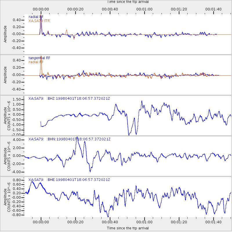
Earthquake location: Southern Sumatra, Indonesia
Earthquake latitude/longitude: -0.5/99.3
Earthquake time(UTC): 1998/04/01 (091) 17:56:23 GMT
Earthquake Depth: 56 km
Earthquake Magnitude: 6.2 MB, 6.9 MS, 7.0 UNKNOWN, 6.6 ME
Earthquake Catalog/Contributor: WHDF/NEIC
Network: XA Anatomy of an Archean Craton, South Africa
Station: SA79 XA.SA79
Lat/Lon: 20.02 S/30.52 E
Elevation: 1078 m
Distance: 69.9 deg
Az: 248.959 deg
Baz: 82.995 deg
Ray Param: 0.055239163
Estimated Moho Depth: 31.25 km
Estimated Crust Vp/Vs: 1.85
Assumed Crust Vp: 6.642 km/s
Estimated Crust Vs: 3.59 km/s
Estimated Crust Poisson's Ratio: 0.29
Radial Match: 88.22707 %
Radial Bump: 335
Transverse Match: 46.11698 %
Transverse Bump: 279
SOD ConfigId: 4480
Insert Time: 2010-02-26 18:33:41.538 +0000
GWidth: 2.5
Max Bumps: 400
Tol: 0.001

Signal To Noise

ChannelStoNSTALTA
XA:SA79: :BHN:19980401T18:06:57.372021Z1.61851471.1014624E-66.80539E-7
XA:SA79: :BHE:19980401T18:06:57.372021Z1.67963839.4098255E-75.602293E-7
XA:SA79: :BHZ:19980401T18:06:57.372021Z0.81402543.0606728E-73.7599227E-7
Arrivals
Ps4.2 SECOND
PpPs13 SECOND
PsPs/PpSs17 SECOND