You are here: Home > Network List > IC - New China Digital Seismograph Network Stations List
> Station HIA Hailar, Neimenggu Autonomous Region, China > Earthquake Result Viewer
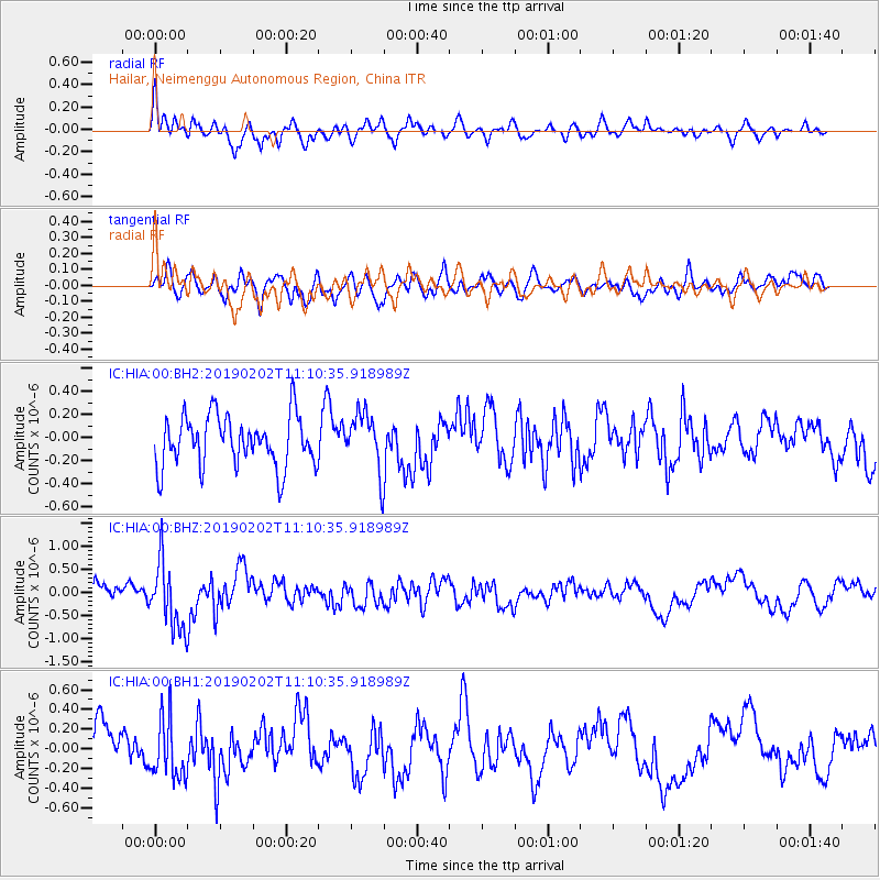
HIA Hailar, Neimenggu Autonomous Region, China - Earthquake Result Viewer
*The percent match for this event was below the threshold and hence no stack was calculated.
| Earthquake location: |
Southern Sumatra, Indonesia |
| Earthquake latitude/longitude: |
-2.7/100.3 |
| Earthquake time(UTC): |
2019/02/02 (033) 11:01:39 GMT |
| Earthquake Depth: |
10 km |
| Earthquake Magnitude: |
5.9 mb |
| Earthquake Catalog/Contributor: |
NEIC PDE/us |
|
| Network: |
IC New China Digital Seismograph Network |
| Station: |
HIA Hailar, Neimenggu Autonomous Region, China |
| Lat/Lon: |
49.27 N/119.74 E |
| Elevation: |
620 m |
|
| Distance: |
54.4 deg |
| Az: |
15.516 deg |
| Baz: |
204.077 deg |
| Ray Param: |
$rayparam |
*The percent match for this event was below the threshold and hence was not used in the summary stack. |
|
| Radial Match: |
65.4463 % |
| Radial Bump: |
400 |
| Transverse Match: |
60.2781 % |
| Transverse Bump: |
400 |
| SOD ConfigId: |
3287751 |
| Insert Time: |
2019-02-16 11:11:48.362 +0000 |
| GWidth: |
2.5 |
| Max Bumps: |
400 |
| Tol: |
0.001 |
|
Signal To Noise
| Channel | StoN | STA | LTA |
| IC:HIA:00:BHZ:20190202T11:10:35.918989Z | 3.1996102 | 7.321244E-7 | 2.2881675E-7 |
| IC:HIA:00:BH1:20190202T11:10:35.918989Z | 1.8030022 | 3.0842963E-7 | 1.7106447E-7 |
| IC:HIA:00:BH2:20190202T11:10:35.918989Z | 1.1386993 | 2.4943267E-7 | 2.190505E-7 |
| Arrivals |
| Ps | |
| PpPs | |
| PsPs/PpSs | |


