You are here: Home > Network List > IC - New China Digital Seismograph Network Stations List
> Station HIA Hailar, Neimenggu Province, China > Earthquake Result Viewer
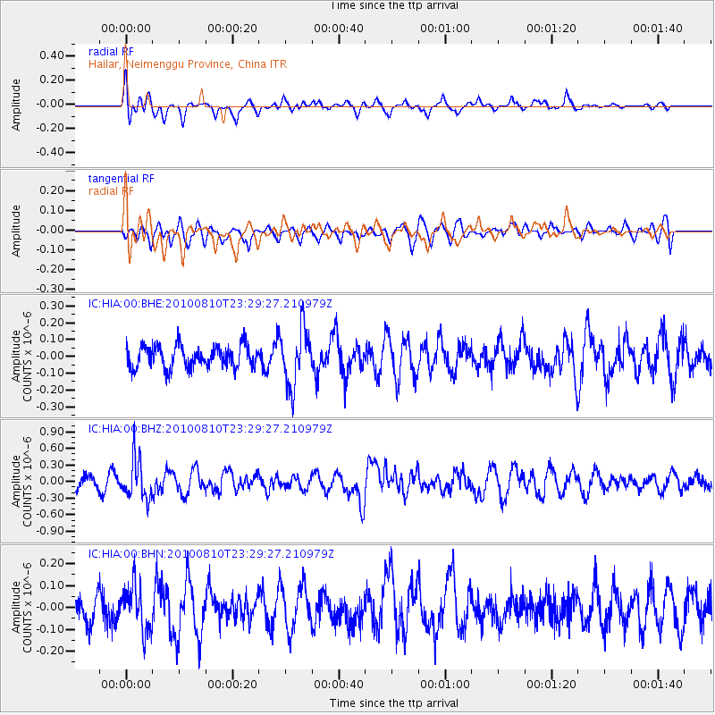
HIA Hailar, Neimenggu Province, China - Earthquake Result Viewer
*The percent match for this event was below the threshold and hence no stack was calculated.
| Earthquake location: |
Vanuatu Islands |
| Earthquake latitude/longitude: |
-14.5/167.3 |
| Earthquake time(UTC): |
2010/08/10 (222) 23:18:31 GMT |
| Earthquake Depth: |
192 km |
| Earthquake Magnitude: |
5.9 MW, 5.4 MB, 5.9 MW |
| Earthquake Catalog/Contributor: |
WHDF/NEIC |
|
| Network: |
IC New China Digital Seismograph Network |
| Station: |
HIA Hailar, Neimenggu Province, China |
| Lat/Lon: |
49.27 N/119.74 E |
| Elevation: |
610 m |
|
| Distance: |
76.1 deg |
| Az: |
330.108 deg |
| Baz: |
132.523 deg |
| Ray Param: |
$rayparam |
*The percent match for this event was below the threshold and hence was not used in the summary stack. |
|
| Radial Match: |
55.277927 % |
| Radial Bump: |
400 |
| Transverse Match: |
60.58849 % |
| Transverse Bump: |
400 |
| SOD ConfigId: |
319893 |
| Insert Time: |
2011-01-05 19:51:23.963 +0000 |
| GWidth: |
2.5 |
| Max Bumps: |
400 |
| Tol: |
0.001 |
|
Signal To Noise
| Channel | StoN | STA | LTA |
| IC:HIA:00:BHZ:20100810T23:29:27.210979Z | 2.5318618 | 3.5775514E-7 | 1.4130121E-7 |
| IC:HIA:00:BHN:20100810T23:29:27.210979Z | 1.1786019 | 1.05592314E-7 | 8.959117E-8 |
| IC:HIA:00:BHE:20100810T23:29:27.210979Z | 2.534023 | 1.6896436E-7 | 6.667831E-8 |
| Arrivals |
| Ps | |
| PpPs | |
| PsPs/PpSs | |


