You are here: Home > Network List > IC - New China Digital Seismograph Network Stations List
> Station HIA Hailar, Neimenggu Autonomous Region, China > Earthquake Result Viewer
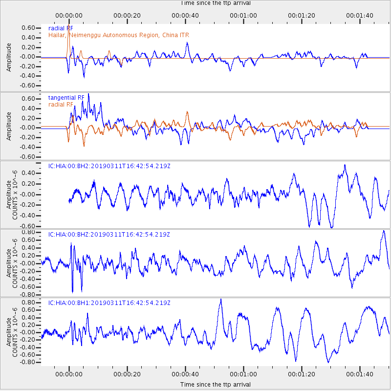
HIA Hailar, Neimenggu Autonomous Region, China - Earthquake Result Viewer
*The percent match for this event was below the threshold and hence no stack was calculated.
| Earthquake location: |
Northern Sumatra, Indonesia |
| Earthquake latitude/longitude: |
1.2/98.8 |
| Earthquake time(UTC): |
2019/03/11 (070) 16:34:28 GMT |
| Earthquake Depth: |
73 km |
| Earthquake Magnitude: |
5.4 Mww |
| Earthquake Catalog/Contributor: |
NEIC PDE/us |
|
| Network: |
IC New China Digital Seismograph Network |
| Station: |
HIA Hailar, Neimenggu Autonomous Region, China |
| Lat/Lon: |
49.27 N/119.74 E |
| Elevation: |
620 m |
|
| Distance: |
51.2 deg |
| Az: |
17.495 deg |
| Baz: |
207.314 deg |
| Ray Param: |
$rayparam |
*The percent match for this event was below the threshold and hence was not used in the summary stack. |
|
| Radial Match: |
42.285797 % |
| Radial Bump: |
400 |
| Transverse Match: |
64.914856 % |
| Transverse Bump: |
400 |
| SOD ConfigId: |
3338192 |
| Insert Time: |
2019-03-25 16:46:41.891 +0000 |
| GWidth: |
2.5 |
| Max Bumps: |
400 |
| Tol: |
0.001 |
|
Signal To Noise
| Channel | StoN | STA | LTA |
| IC:HIA:00:BHZ:20190311T16:42:54.219Z | 2.0914218 | 2.8969276E-7 | 1.3851475E-7 |
| IC:HIA:00:BH1:20190311T16:42:54.219Z | 1.8408775 | 1.6547384E-7 | 8.9888566E-8 |
| IC:HIA:00:BH2:20190311T16:42:54.219Z | 0.9007309 | 1.13097435E-7 | 1.2556184E-7 |
| Arrivals |
| Ps | |
| PpPs | |
| PsPs/PpSs | |


