You are here: Home > Network List > TA - USArray Transportable Network (new EarthScope stations) Stations List
> Station 034A Hebronville, TX, USA > Earthquake Result Viewer
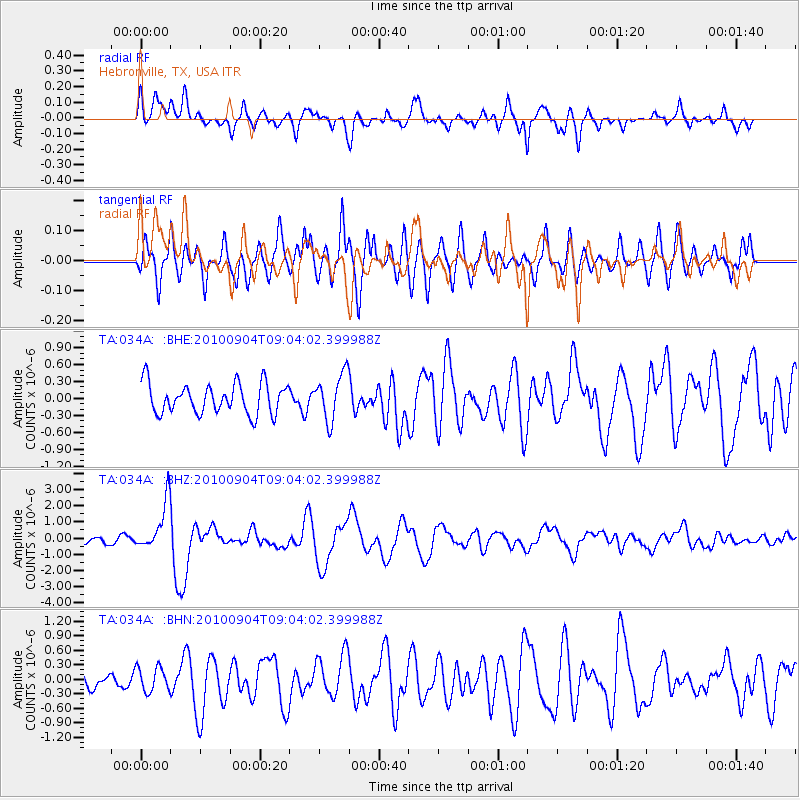
034A Hebronville, TX, USA - Earthquake Result Viewer
*The percent match for this event was below the threshold and hence no stack was calculated.
| Earthquake location: |
Tonga Islands |
| Earthquake latitude/longitude: |
-17.4/-174.0 |
| Earthquake time(UTC): |
2010/09/04 (247) 08:52:04 GMT |
| Earthquake Depth: |
69 km |
| Earthquake Magnitude: |
5.9 MB, 6.1 MW, 6.0 MW |
| Earthquake Catalog/Contributor: |
WHDF/NEIC |
|
| Network: |
TA USArray Transportable Network (new EarthScope stations) |
| Station: |
034A Hebronville, TX, USA |
| Lat/Lon: |
27.06 N/98.68 W |
| Elevation: |
155 m |
|
| Distance: |
85.3 deg |
| Az: |
59.938 deg |
| Baz: |
247.953 deg |
| Ray Param: |
$rayparam |
*The percent match for this event was below the threshold and hence was not used in the summary stack. |
|
| Radial Match: |
72.980095 % |
| Radial Bump: |
400 |
| Transverse Match: |
69.116585 % |
| Transverse Bump: |
400 |
| SOD ConfigId: |
319893 |
| Insert Time: |
2011-01-13 08:18:32.736 +0000 |
| GWidth: |
2.5 |
| Max Bumps: |
400 |
| Tol: |
0.001 |
|
Signal To Noise
| Channel | StoN | STA | LTA |
| TA:034A: :BHZ:20100904T09:04:02.399988Z | 7.199196 | 1.5055336E-6 | 2.0912526E-7 |
| TA:034A: :BHN:20100904T09:04:02.399988Z | 1.0267816 | 2.5216556E-7 | 2.4558832E-7 |
| TA:034A: :BHE:20100904T09:04:02.399988Z | 1.5460974 | 4.1073878E-7 | 2.6566164E-7 |
| Arrivals |
| Ps | |
| PpPs | |
| PsPs/PpSs | |


