You are here: Home > Network List > IC - New China Digital Seismograph Network Stations List
> Station HIA Hailar, Neimenggu Autonomous Region, China > Earthquake Result Viewer
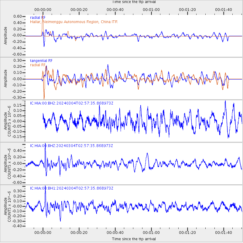
HIA Hailar, Neimenggu Autonomous Region, China - Earthquake Result Viewer
*The percent match for this event was below the threshold and hence no stack was calculated.
| Earthquake location: |
Southern Sumatra, Indonesia |
| Earthquake latitude/longitude: |
-5.8/102.2 |
| Earthquake time(UTC): |
2024/03/04 (064) 02:48:21 GMT |
| Earthquake Depth: |
10 km |
| Earthquake Magnitude: |
5.5 mb |
| Earthquake Catalog/Contributor: |
NEIC PDE/us |
|
| Network: |
IC New China Digital Seismograph Network |
| Station: |
HIA Hailar, Neimenggu Autonomous Region, China |
| Lat/Lon: |
49.27 N/119.74 E |
| Elevation: |
620 m |
|
| Distance: |
57.0 deg |
| Az: |
13.633 deg |
| Baz: |
200.979 deg |
| Ray Param: |
$rayparam |
*The percent match for this event was below the threshold and hence was not used in the summary stack. |
|
| Radial Match: |
42.851315 % |
| Radial Bump: |
400 |
| Transverse Match: |
55.03426 % |
| Transverse Bump: |
400 |
| SOD ConfigId: |
33437571 |
| Insert Time: |
2024-03-18 02:55:13.317 +0000 |
| GWidth: |
2.5 |
| Max Bumps: |
400 |
| Tol: |
0.001 |
|
Signal To Noise
| Channel | StoN | STA | LTA |
| IC:HIA:00:BHZ:20240304T02:57:35.868973Z | 4.022297 | 1.9530843E-7 | 4.8556444E-8 |
| IC:HIA:00:BH1:20240304T02:57:35.868973Z | 3.291507 | 1.2985417E-7 | 3.9451283E-8 |
| IC:HIA:00:BH2:20240304T02:57:35.868973Z | 1.1746753 | 5.1533714E-8 | 4.38706E-8 |
| Arrivals |
| Ps | |
| PpPs | |
| PsPs/PpSs | |


