You are here: Home > Network List > IC - New China Digital Seismograph Network Stations List
> Station HIA Hailar, Neimenggu Province, China > Earthquake Result Viewer
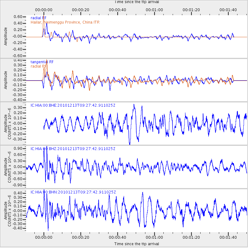
HIA Hailar, Neimenggu Province, China - Earthquake Result Viewer
*The percent match for this event was below the threshold and hence no stack was calculated.
| Earthquake location: |
Sunda Strait, Indonesia |
| Earthquake latitude/longitude: |
-6.3/104.0 |
| Earthquake time(UTC): |
2010/12/13 (347) 09:18:32 GMT |
| Earthquake Depth: |
43 km |
| Earthquake Magnitude: |
5.7 MB, 5.4 MS, 5.7 MW, 5.6 MW |
| Earthquake Catalog/Contributor: |
WHDF/NEIC |
|
| Network: |
IC New China Digital Seismograph Network |
| Station: |
HIA Hailar, Neimenggu Province, China |
| Lat/Lon: |
49.27 N/119.74 E |
| Elevation: |
620 m |
|
| Distance: |
57.0 deg |
| Az: |
12.229 deg |
| Baz: |
198.753 deg |
| Ray Param: |
$rayparam |
*The percent match for this event was below the threshold and hence was not used in the summary stack. |
|
| Radial Match: |
73.90259 % |
| Radial Bump: |
400 |
| Transverse Match: |
59.87685 % |
| Transverse Bump: |
387 |
| SOD ConfigId: |
343951 |
| Insert Time: |
2011-05-24 14:33:57.178 +0000 |
| GWidth: |
2.5 |
| Max Bumps: |
400 |
| Tol: |
0.001 |
|
Signal To Noise
| Channel | StoN | STA | LTA |
| IC:HIA:00:BHZ:20101213T09:27:42.911025Z | 4.011991 | 4.2056084E-7 | 1.0482597E-7 |
| IC:HIA:00:BHN:20101213T09:27:42.911025Z | 1.7485245 | 2.105744E-7 | 1.2042976E-7 |
| IC:HIA:00:BHE:20101213T09:27:42.911025Z | 1.5557425 | 1.3314826E-7 | 8.558503E-8 |
| Arrivals |
| Ps | |
| PpPs | |
| PsPs/PpSs | |


