You are here: Home > Network List > IC - New China Digital Seismograph Network Stations List
> Station HIA Hailar, Neimenggu Province, China > Earthquake Result Viewer
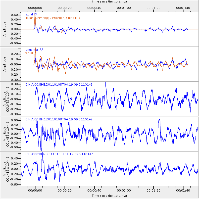
HIA Hailar, Neimenggu Province, China - Earthquake Result Viewer
*The percent match for this event was below the threshold and hence no stack was calculated.
| Earthquake location: |
Southern Molucca Sea |
| Earthquake latitude/longitude: |
-0.0/124.9 |
| Earthquake time(UTC): |
2011/01/08 (008) 04:10:56 GMT |
| Earthquake Depth: |
57 km |
| Earthquake Magnitude: |
5.6 MB, 5.6 MW |
| Earthquake Catalog/Contributor: |
WHDF/NEIC |
|
| Network: |
IC New China Digital Seismograph Network |
| Station: |
HIA Hailar, Neimenggu Province, China |
| Lat/Lon: |
49.27 N/119.74 E |
| Elevation: |
620 m |
|
| Distance: |
49.3 deg |
| Az: |
355.534 deg |
| Baz: |
173.172 deg |
| Ray Param: |
$rayparam |
*The percent match for this event was below the threshold and hence was not used in the summary stack. |
|
| Radial Match: |
52.27274 % |
| Radial Bump: |
358 |
| Transverse Match: |
53.04224 % |
| Transverse Bump: |
400 |
| SOD ConfigId: |
346946 |
| Insert Time: |
2011-07-09 06:51:39.505 +0000 |
| GWidth: |
2.5 |
| Max Bumps: |
400 |
| Tol: |
0.001 |
|
Signal To Noise
| Channel | StoN | STA | LTA |
| IC:HIA:00:BHZ:20110108T04:19:09.511014Z | 2.418911 | 3.655609E-7 | 1.5112623E-7 |
| IC:HIA:00:BHN:20110108T04:19:09.511014Z | 2.2268233 | 2.9916364E-7 | 1.3434548E-7 |
| IC:HIA:00:BHE:20110108T04:19:09.511014Z | 1.0934108 | 1.2678451E-7 | 1.1595322E-7 |
| Arrivals |
| Ps | |
| PpPs | |
| PsPs/PpSs | |


