You are here: Home > Network List > XG92 - Rocky Mountain Front Stations List
> Station LED Leadville, CO > Earthquake Result Viewer
LED Leadville, CO - Earthquake Result Viewer

| Earthquake location: |
South Of Panama |
| Earthquake latitude/longitude: |
6.1/-82.4 |
| Earthquake time(UTC): |
1992/06/26 (178) 11:32:30 GMT |
| Earthquake Depth: |
33 km |
| Earthquake Magnitude: |
5.8 MB, 5.4 MS |
| Earthquake Catalog/Contributor: |
WHDF/NEIC |
|
| Network: |
XG Rocky Mountain Front |
| Station: |
LED Leadville, CO |
| Lat/Lon: |
39.15 N/106.35 W |
| Elevation: |
2879 m |
|
| Distance: |
39.4 deg |
| Az: |
330.122 deg |
| Baz: |
140.425 deg |
| Ray Param: |
0.0749629 |
| Estimated Moho Depth: |
52.25 km |
| Estimated Crust Vp/Vs: |
1.87 |
| Assumed Crust Vp: |
6.306 km/s |
| Estimated Crust Vs: |
3.368 km/s |
| Estimated Crust Poisson's Ratio: |
0.30 |
|
| Radial Match: |
87.68517 % |
| Radial Bump: |
386 |
| Transverse Match: |
89.40177 % |
| Transverse Bump: |
400 |
| SOD ConfigId: |
3286 |
| Insert Time: |
2010-02-25 20:09:46.715 +0000 |
| GWidth: |
2.5 |
| Max Bumps: |
400 |
| Tol: |
0.001 |
|
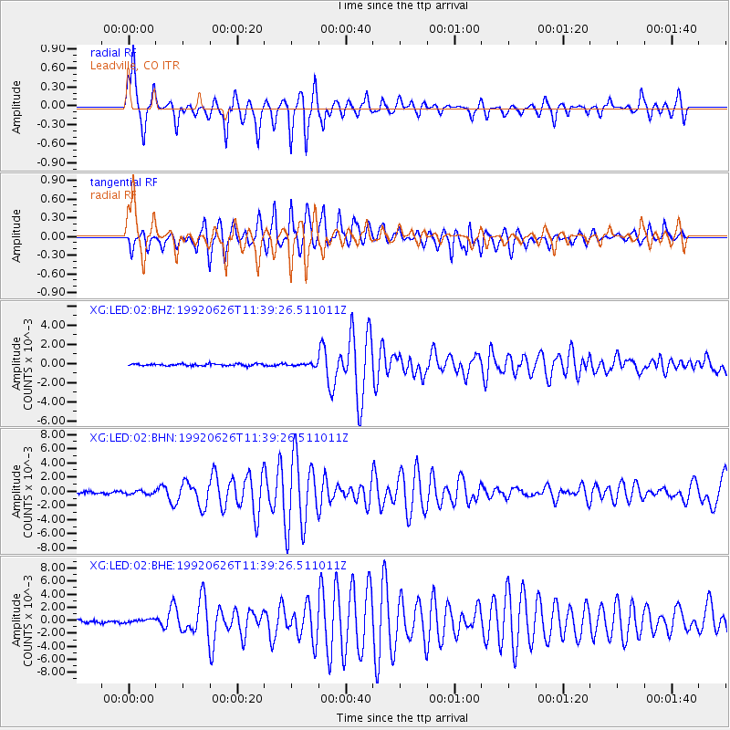
Signal To Noise
| Channel | StoN | STA | LTA |
| XG:LED:02:BHN:19920626T11:39:26.511011Z | 1.3285933 | 2.3280135E-4 | 1.7522395E-4 |
| XG:LED:02:BHE:19920626T11:39:26.511011Z | 1.0720284 | 2.9993008E-4 | 2.7977812E-4 |
| XG:LED:02:BHZ:19920626T11:39:26.511011Z | 1.197294 | 1.1634057E-4 | 9.71696E-5 |
| Arrivals |
| Ps | 7.7 SECOND |
| PpPs | 22 SECOND |
| PsPs/PpSs | 30 SECOND |


