You are here: Home > Network List > IC - New China Digital Seismograph Network Stations List
> Station HIA Hailar, Neimenggu Province, China > Earthquake Result Viewer
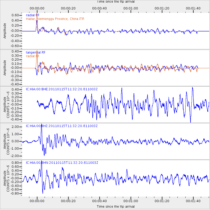
HIA Hailar, Neimenggu Province, China - Earthquake Result Viewer
*The percent match for this event was below the threshold and hence no stack was calculated.
| Earthquake location: |
Northern Sumatra, Indonesia |
| Earthquake latitude/longitude: |
2.5/96.3 |
| Earthquake time(UTC): |
2011/01/15 (015) 11:23:53 GMT |
| Earthquake Depth: |
19 km |
| Earthquake Magnitude: |
5.8 MB, 5.6 MS, 5.8 MW, 5.7 MW |
| Earthquake Catalog/Contributor: |
WHDF/NEIC |
|
| Network: |
IC New China Digital Seismograph Network |
| Station: |
HIA Hailar, Neimenggu Province, China |
| Lat/Lon: |
49.27 N/119.74 E |
| Elevation: |
620 m |
|
| Distance: |
50.7 deg |
| Az: |
19.676 deg |
| Baz: |
210.901 deg |
| Ray Param: |
$rayparam |
*The percent match for this event was below the threshold and hence was not used in the summary stack. |
|
| Radial Match: |
75.691086 % |
| Radial Bump: |
400 |
| Transverse Match: |
59.285828 % |
| Transverse Bump: |
400 |
| SOD ConfigId: |
346946 |
| Insert Time: |
2011-07-12 07:08:44.682 +0000 |
| GWidth: |
2.5 |
| Max Bumps: |
400 |
| Tol: |
0.001 |
|
Signal To Noise
| Channel | StoN | STA | LTA |
| IC:HIA:00:BHZ:20110115T11:32:20.811003Z | 8.8237705 | 9.546733E-7 | 1.08193355E-7 |
| IC:HIA:00:BHN:20110115T11:32:20.811003Z | 5.858539 | 4.1513087E-7 | 7.085911E-8 |
| IC:HIA:00:BHE:20110115T11:32:20.811003Z | 1.3265638 | 1.4695193E-7 | 1.1077638E-7 |
| Arrivals |
| Ps | |
| PpPs | |
| PsPs/PpSs | |


