You are here: Home > Network List > IC - New China Digital Seismograph Network Stations List
> Station HIA Hailar, Neimenggu Province, China > Earthquake Result Viewer
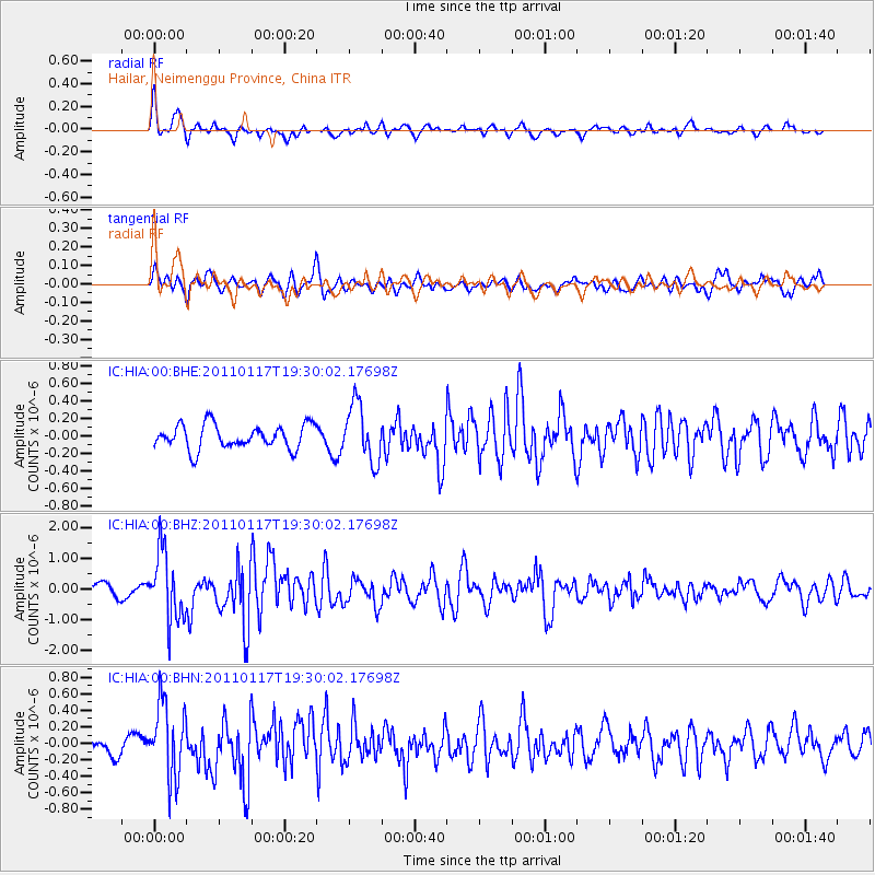
HIA Hailar, Neimenggu Province, China - Earthquake Result Viewer
*The percent match for this event was below the threshold and hence no stack was calculated.
| Earthquake location: |
Southern Sumatra, Indonesia |
| Earthquake latitude/longitude: |
-5.0/102.6 |
| Earthquake time(UTC): |
2011/01/17 (017) 19:20:57 GMT |
| Earthquake Depth: |
36 km |
| Earthquake Magnitude: |
6.1 MB, 5.9 MS, 6.0 MW, 6.0 MW |
| Earthquake Catalog/Contributor: |
WHDF/NEIC |
|
| Network: |
IC New China Digital Seismograph Network |
| Station: |
HIA Hailar, Neimenggu Province, China |
| Lat/Lon: |
49.27 N/119.74 E |
| Elevation: |
620 m |
|
| Distance: |
56.1 deg |
| Az: |
13.414 deg |
| Baz: |
200.661 deg |
| Ray Param: |
$rayparam |
*The percent match for this event was below the threshold and hence was not used in the summary stack. |
|
| Radial Match: |
70.28319 % |
| Radial Bump: |
381 |
| Transverse Match: |
65.44781 % |
| Transverse Bump: |
400 |
| SOD ConfigId: |
346946 |
| Insert Time: |
2011-07-12 07:32:55.996 +0000 |
| GWidth: |
2.5 |
| Max Bumps: |
400 |
| Tol: |
0.001 |
|
Signal To Noise
| Channel | StoN | STA | LTA |
| IC:HIA:00:BHZ:20110117T19:30:02.17698Z | 6.7477717 | 1.1115463E-6 | 1.6472792E-7 |
| IC:HIA:00:BHN:20110117T19:30:02.17698Z | 3.0941815 | 4.5109968E-7 | 1.4578966E-7 |
| IC:HIA:00:BHE:20110117T19:30:02.17698Z | 2.3731754 | 3.2269364E-7 | 1.3597547E-7 |
| Arrivals |
| Ps | |
| PpPs | |
| PsPs/PpSs | |


