GLA AZ.GLA - Earthquake Result Viewer
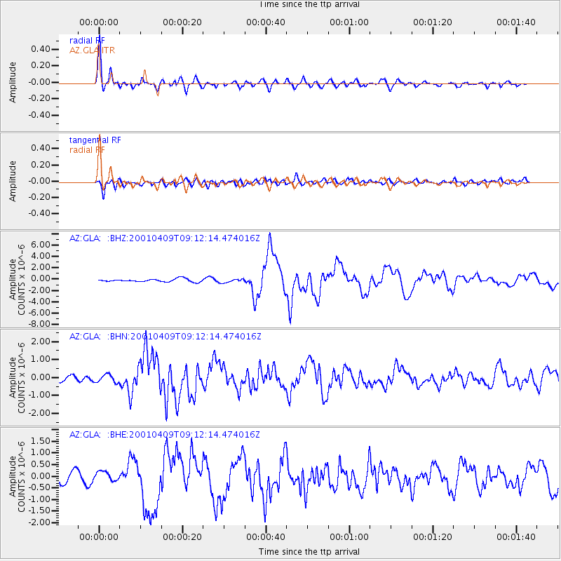
Earthquake location: Off Coast Of Central Chile
Earthquake latitude/longitude: -32.7/-73.1
Earthquake time(UTC): 2001/04/09 (099) 09:00:57 GMT
Earthquake Depth: 11 km
Earthquake Magnitude: 6.1 MB, 6.3 MS, 6.7 MW, 6.3 ME
Earthquake Catalog/Contributor: WHDF/NEIC
Network: AZ ANZA Regional Network
Station: GLA AZ.GLA
Lat/Lon: 33.05 N/114.83 W
Elevation: 579 m
Distance: 76.3 deg
Az: 324.879 deg
Baz: 144.706 deg
Ray Param: 0.051097464
Estimated Moho Depth: 27.25 km
Estimated Crust Vp/Vs: 1.64
Assumed Crust Vp: 6.155 km/s
Estimated Crust Vs: 3.747 km/s
Estimated Crust Poisson's Ratio: 0.21
Radial Match: 94.68647 %
Radial Bump: 400
Transverse Match: 83.45922 %
Transverse Bump: 400
SOD ConfigId: 4714
Insert Time: 2010-02-26 19:24:05.055 +0000
GWidth: 2.5
Max Bumps: 400
Tol: 0.001

Signal To Noise

ChannelStoNSTALTA
AZ:GLA: :BHN:20010409T09:12:14.474016Z1.53345822.1785628E-71.4206861E-7
AZ:GLA: :BHE:20010409T09:12:14.474016Z1.06162812.2869507E-72.1541918E-7
AZ:GLA: :BHZ:20010409T09:12:14.474016Z1.18153493.0659638E-72.594899E-7
Arrivals
Ps2.9 SECOND
PpPs11 SECOND
PsPs/PpSs14 SECOND