You are here: Home > Network List > IC - New China Digital Seismograph Network Stations List
> Station HIA Hailar, Neimenggu Province, China > Earthquake Result Viewer
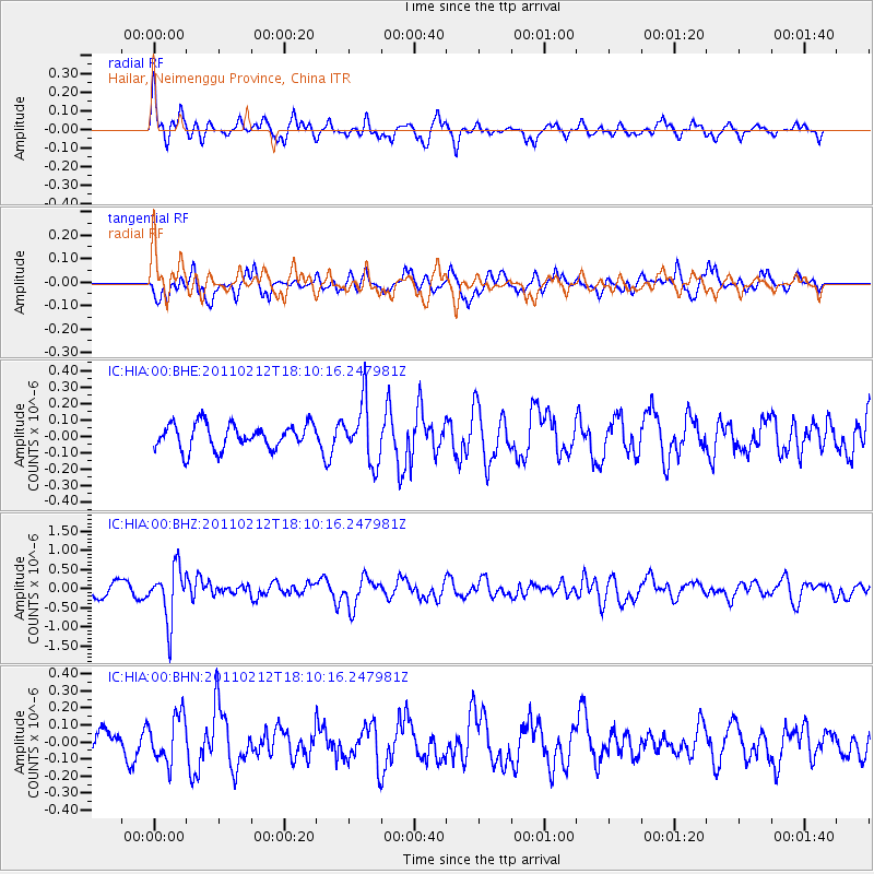
HIA Hailar, Neimenggu Province, China - Earthquake Result Viewer
*The percent match for this event was below the threshold and hence no stack was calculated.
| Earthquake location: |
Tonga Islands |
| Earthquake latitude/longitude: |
-20.9/-175.7 |
| Earthquake time(UTC): |
2011/02/12 (043) 17:57:56 GMT |
| Earthquake Depth: |
90 km |
| Earthquake Magnitude: |
6.0 MB, 6.1 MW, 6.1 MW |
| Earthquake Catalog/Contributor: |
WHDF/NEIC |
|
| Network: |
IC New China Digital Seismograph Network |
| Station: |
HIA Hailar, Neimenggu Province, China |
| Lat/Lon: |
49.27 N/119.74 E |
| Elevation: |
620 m |
|
| Distance: |
90.3 deg |
| Az: |
323.728 deg |
| Baz: |
122.37 deg |
| Ray Param: |
$rayparam |
*The percent match for this event was below the threshold and hence was not used in the summary stack. |
|
| Radial Match: |
69.58869 % |
| Radial Bump: |
384 |
| Transverse Match: |
62.938515 % |
| Transverse Bump: |
400 |
| SOD ConfigId: |
350818 |
| Insert Time: |
2011-07-26 07:56:43.126 +0000 |
| GWidth: |
2.5 |
| Max Bumps: |
400 |
| Tol: |
0.001 |
|
Signal To Noise
| Channel | StoN | STA | LTA |
| IC:HIA:00:BHZ:20110212T18:10:16.247981Z | 4.9441423 | 6.815099E-7 | 1.378419E-7 |
| IC:HIA:00:BHN:20110212T18:10:16.247981Z | 2.3085244 | 1.3702058E-7 | 5.935419E-8 |
| IC:HIA:00:BHE:20110212T18:10:16.247981Z | 2.409033 | 1.8072814E-7 | 7.502103E-8 |
| Arrivals |
| Ps | |
| PpPs | |
| PsPs/PpSs | |


