You are here: Home > Network List > TA - USArray Transportable Network (new EarthScope stations) Stations List
> Station 034A Hebronville, TX, USA > Earthquake Result Viewer
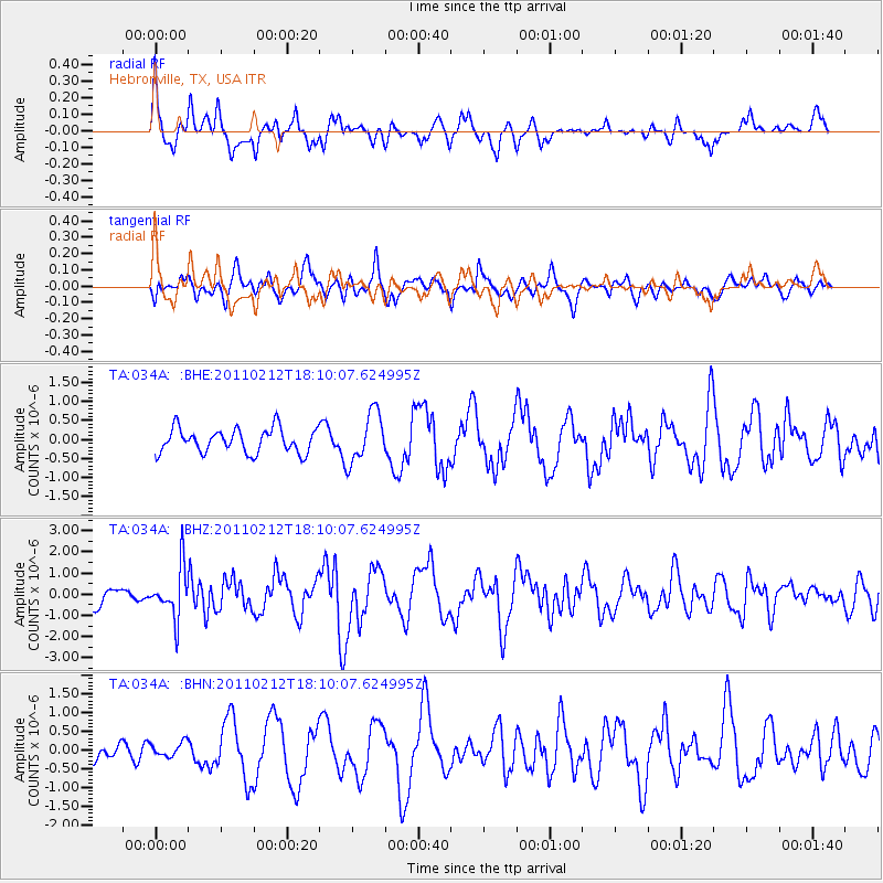
034A Hebronville, TX, USA - Earthquake Result Viewer
*The percent match for this event was below the threshold and hence no stack was calculated.
| Earthquake location: |
Tonga Islands |
| Earthquake latitude/longitude: |
-20.9/-175.7 |
| Earthquake time(UTC): |
2011/02/12 (043) 17:57:56 GMT |
| Earthquake Depth: |
90 km |
| Earthquake Magnitude: |
6.0 MB, 6.1 MW, 6.1 MW |
| Earthquake Catalog/Contributor: |
WHDF/NEIC |
|
| Network: |
TA USArray Transportable Network (new EarthScope stations) |
| Station: |
034A Hebronville, TX, USA |
| Lat/Lon: |
27.06 N/98.68 W |
| Elevation: |
155 m |
|
| Distance: |
88.4 deg |
| Az: |
60.361 deg |
| Baz: |
245.702 deg |
| Ray Param: |
$rayparam |
*The percent match for this event was below the threshold and hence was not used in the summary stack. |
|
| Radial Match: |
52.335007 % |
| Radial Bump: |
400 |
| Transverse Match: |
55.723263 % |
| Transverse Bump: |
400 |
| SOD ConfigId: |
350818 |
| Insert Time: |
2011-07-26 08:43:14.403 +0000 |
| GWidth: |
2.5 |
| Max Bumps: |
400 |
| Tol: |
0.001 |
|
Signal To Noise
| Channel | StoN | STA | LTA |
| TA:034A: :BHZ:20110212T18:10:07.624995Z | 2.405538 | 1.1808268E-6 | 4.9087845E-7 |
| TA:034A: :BHN:20110212T18:10:07.624995Z | 0.6527842 | 1.9196914E-7 | 2.9407747E-7 |
| TA:034A: :BHE:20110212T18:10:07.624995Z | 2.0742342 | 6.5690347E-7 | 3.1669686E-7 |
| Arrivals |
| Ps | |
| PpPs | |
| PsPs/PpSs | |


