You are here: Home > Network List > XG92 - Rocky Mountain Front Stations List
> Station MON Montrose, CO > Earthquake Result Viewer
MON Montrose, CO - Earthquake Result Viewer

| Earthquake location: |
Hokkaido, Japan Region |
| Earthquake latitude/longitude: |
41.9/140.7 |
| Earthquake time(UTC): |
1992/08/24 (237) 06:59:40 GMT |
| Earthquake Depth: |
127 km |
| Earthquake Magnitude: |
6.2 MB |
| Earthquake Catalog/Contributor: |
WHDF/NEIC |
|
| Network: |
XG Rocky Mountain Front |
| Station: |
MON Montrose, CO |
| Lat/Lon: |
38.53 N/108.00 W |
| Elevation: |
2097 m |
|
| Distance: |
78.4 deg |
| Az: |
48.246 deg |
| Baz: |
314.794 deg |
| Ray Param: |
0.049353614 |
| Estimated Moho Depth: |
44.0 km |
| Estimated Crust Vp/Vs: |
1.90 |
| Assumed Crust Vp: |
6.306 km/s |
| Estimated Crust Vs: |
3.31 km/s |
| Estimated Crust Poisson's Ratio: |
0.31 |
|
| Radial Match: |
84.63227 % |
| Radial Bump: |
400 |
| Transverse Match: |
80.19932 % |
| Transverse Bump: |
400 |
| SOD ConfigId: |
3286 |
| Insert Time: |
2010-02-25 20:10:29.141 +0000 |
| GWidth: |
2.5 |
| Max Bumps: |
400 |
| Tol: |
0.001 |
|
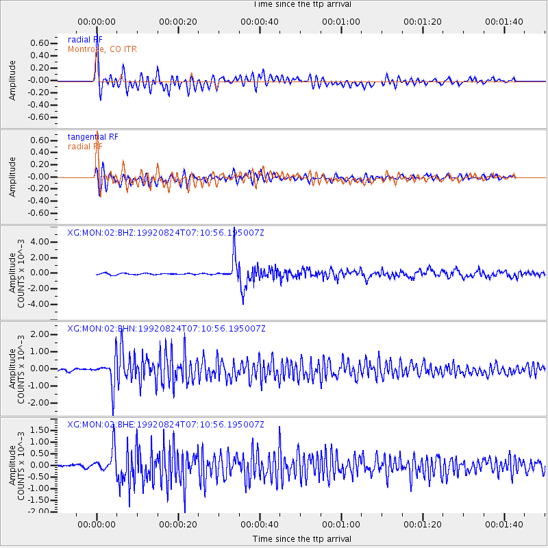
Signal To Noise
| Channel | StoN | STA | LTA |
| XG:MON:02:BHN:19920824T07:10:56.195007Z | 13.019374 | 8.3038403E-4 | 6.3780644E-5 |
| XG:MON:02:BHE:19920824T07:10:56.195007Z | 10.680929 | 5.2079646E-4 | 4.875947E-5 |
| XG:MON:02:BHZ:19920824T07:10:56.195007Z | 17.086042 | 0.0015404994 | 9.016128E-5 |
| Arrivals |
| Ps | 6.5 SECOND |
| PpPs | 20 SECOND |
| PsPs/PpSs | 26 SECOND |


