You are here: Home > Network List > XG92 - Rocky Mountain Front Stations List
> Station YUM Yuma, CO > Earthquake Result Viewer
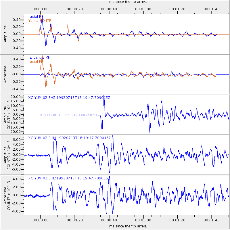
YUM Yuma, CO - Earthquake Result Viewer

| Earthquake location: |
Northern Peru |
| Earthquake latitude/longitude: |
-3.9/-76.6 |
| Earthquake time(UTC): |
1992/07/13 (195) 18:11:34 GMT |
| Earthquake Depth: |
100 km |
| Earthquake Magnitude: |
6.2 MB |
| Earthquake Catalog/Contributor: |
WHDF/NEIC |
|
| Network: |
XG Rocky Mountain Front |
| Station: |
YUM Yuma, CO |
| Lat/Lon: |
40.16 N/102.78 W |
| Elevation: |
1284 m |
|
| Distance: |
50.0 deg |
| Az: |
333.841 deg |
| Baz: |
144.974 deg |
| Ray Param: |
0.06800874 |
| Estimated Moho Depth: |
15.5 km |
| Estimated Crust Vp/Vs: |
1.82 |
| Assumed Crust Vp: |
6.483 km/s |
| Estimated Crust Vs: |
3.557 km/s |
| Estimated Crust Poisson's Ratio: |
0.28 |
|
| Radial Match: |
95.08938 % |
| Radial Bump: |
303 |
| Transverse Match: |
88.155975 % |
| Transverse Bump: |
400 |
| SOD ConfigId: |
3286 |
| Insert Time: |
2010-02-25 20:12:33.030 +0000 |
| GWidth: |
2.5 |
| Max Bumps: |
400 |
| Tol: |
0.001 |
|
Signal To Noise
| Channel | StoN | STA | LTA |
| XG:YUM:02:BHN:19920713T18:19:47.709015Z | 1.3001659 | 1.5291681E-4 | 1.176133E-4 |
| XG:YUM:02:BHE:19920713T18:19:47.709015Z | 1.0119519 | 1.4241092E-4 | 1.4072894E-4 |
| XG:YUM:02:BHZ:19920713T18:19:47.709015Z | 0.98899066 | 9.5869626E-5 | 9.6936834E-5 |
| Arrivals |
| Ps | 2.1 SECOND |
| PpPs | 6.4 SECOND |
| PsPs/PpSs | 8.5 SECOND |


