You are here: Home > Network List > IC - New China Digital Seismograph Network Stations List
> Station HIA Hailar, Neimenggu Province, China > Earthquake Result Viewer
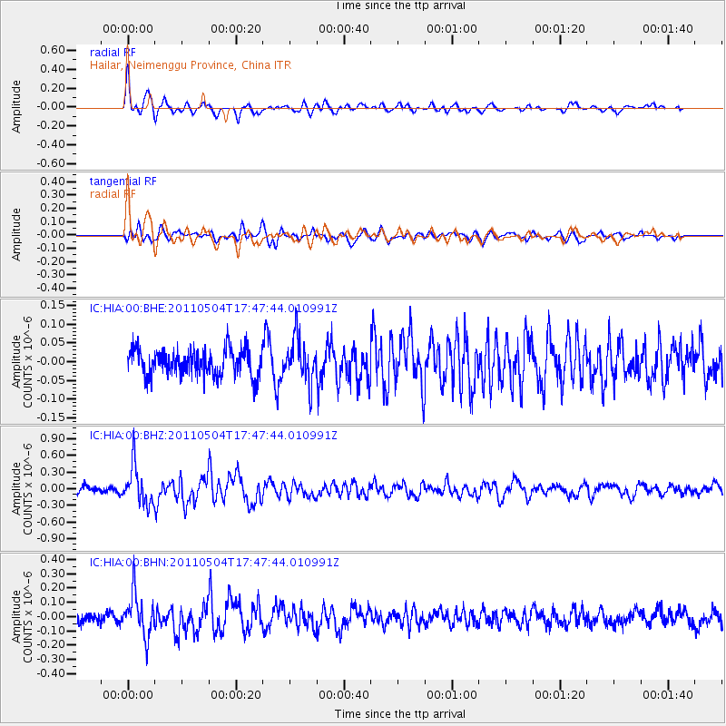
HIA Hailar, Neimenggu Province, China - Earthquake Result Viewer
*The percent match for this event was below the threshold and hence no stack was calculated.
| Earthquake location: |
Southern Sumatra, Indonesia |
| Earthquake latitude/longitude: |
-4.9/101.8 |
| Earthquake time(UTC): |
2011/05/04 (124) 17:38:37 GMT |
| Earthquake Depth: |
26 km |
| Earthquake Magnitude: |
5.5 MW, 5.3 MS, 5.4 MB, 5.4 MW |
| Earthquake Catalog/Contributor: |
WHDF/NEIC |
|
| Network: |
IC New China Digital Seismograph Network |
| Station: |
HIA Hailar, Neimenggu Province, China |
| Lat/Lon: |
49.27 N/119.74 E |
| Elevation: |
620 m |
|
| Distance: |
56.1 deg |
| Az: |
14.024 deg |
| Baz: |
201.631 deg |
| Ray Param: |
$rayparam |
*The percent match for this event was below the threshold and hence was not used in the summary stack. |
|
| Radial Match: |
73.46593 % |
| Radial Bump: |
400 |
| Transverse Match: |
67.051445 % |
| Transverse Bump: |
400 |
| SOD ConfigId: |
356183 |
| Insert Time: |
2011-10-06 07:49:51.195 +0000 |
| GWidth: |
2.5 |
| Max Bumps: |
400 |
| Tol: |
0.001 |
|
Signal To Noise
| Channel | StoN | STA | LTA |
| IC:HIA:00:BHZ:20110504T17:47:44.010991Z | 6.056355 | 3.5414746E-7 | 5.8475347E-8 |
| IC:HIA:00:BHN:20110504T17:47:44.010991Z | 4.97851 | 1.4968631E-7 | 3.006649E-8 |
| IC:HIA:00:BHE:20110504T17:47:44.010991Z | 1.6478512 | 5.8167345E-8 | 3.5298907E-8 |
| Arrivals |
| Ps | |
| PpPs | |
| PsPs/PpSs | |


