
BJI Baijiatuan, Beijing, China - Earthquake Result Viewer
| ||||||||||||||||||
| ||||||||||||||||||
| ||||||||||||||||||
|
Signal To Noise
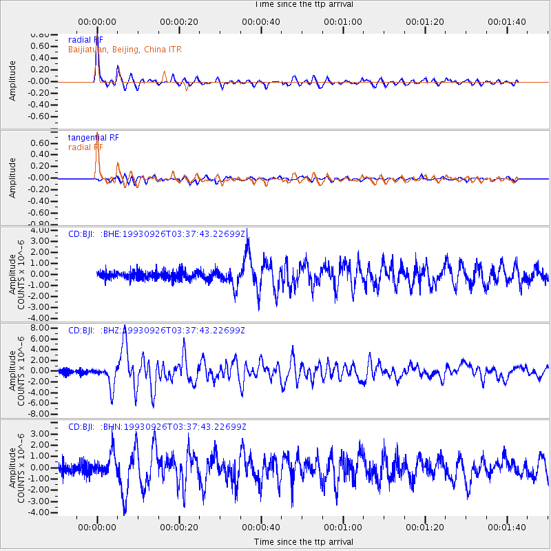
| Channel | StoN | STA | LTA |
| CD:BJI: :BHZ:19930926T03:37:43.22699Z | 7.4589577 | 2.0801276E-6 | 2.7887643E-7 |
| CD:BJI: :BHN:19930926T03:37:43.22699Z | 2.60303 | 1.0068355E-6 | 3.867937E-7 |
| CD:BJI: :BHE:19930926T03:37:43.22699Z | 2.207512 | 7.7844743E-7 | 3.5263568E-7 |
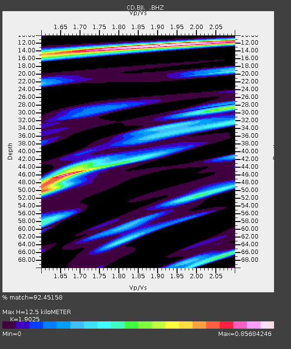
| Arrivals | |
| Ps | 1.9 SECOND |
| PpPs | 5.2 SECOND |
| PsPs/PpSs | 7.1 SECOND |

