
BJI Baijiatuan, Beijing, China - Earthquake Result Viewer
| ||||||||||||||||||
| ||||||||||||||||||
| ||||||||||||||||||
|
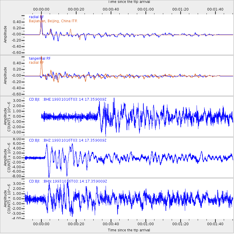
Signal To Noise
| Channel | StoN | STA | LTA |
| CD:BJI: :BHZ:19931016T03:14:17.359009Z | 11.296081 | 3.4263785E-6 | 3.0332455E-7 |
| CD:BJI: :BHN:19931016T03:14:17.359009Z | 2.8772585 | 1.2737818E-6 | 4.4270672E-7 |
| CD:BJI: :BHE:19931016T03:14:17.359009Z | 3.1519086 | 1.1591073E-6 | 3.6774776E-7 |
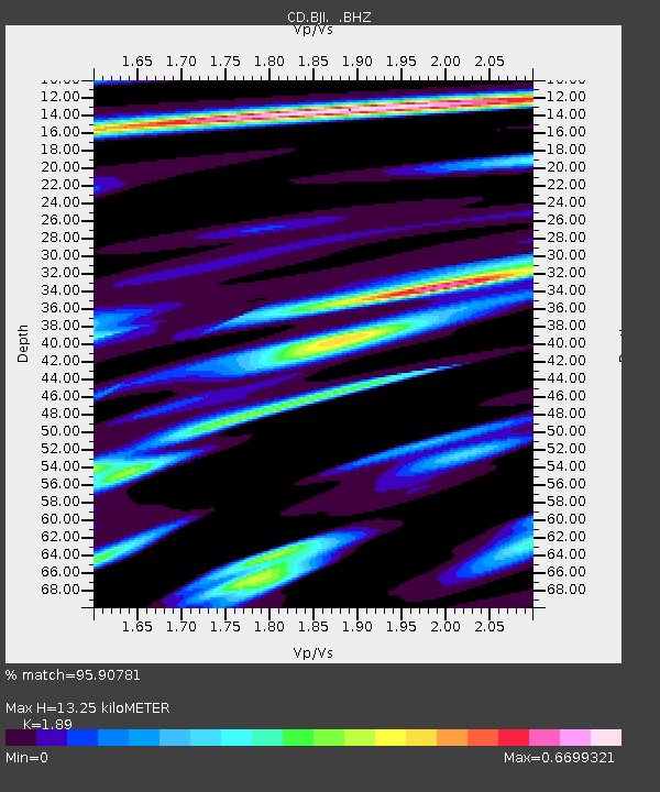
| Arrivals | |
| Ps | 1.9 SECOND |
| PpPs | 5.6 SECOND |
| PsPs/PpSs | 7.5 SECOND |

