
BJI Baijiatuan, Beijing, China - Earthquake Result Viewer
| ||||||||||||||||||
| ||||||||||||||||||
| ||||||||||||||||||
|
Signal To Noise
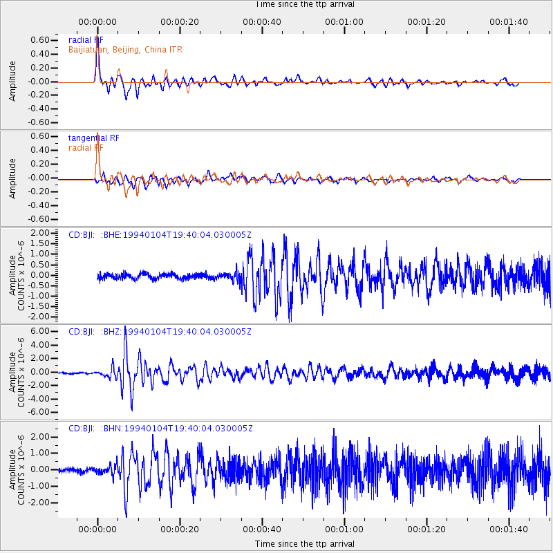
| Channel | StoN | STA | LTA |
| CD:BJI: :BHZ:19940104T19:40:04.030005Z | 4.5145454 | 6.515924E-7 | 1.4433179E-7 |
| CD:BJI: :BHN:19940104T19:40:04.030005Z | 3.348896 | 2.8481494E-7 | 8.504742E-8 |
| CD:BJI: :BHE:19940104T19:40:04.030005Z | 1.6868265 | 2.0047459E-7 | 1.1884718E-7 |
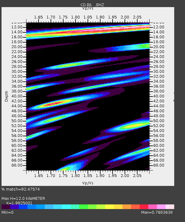
| Arrivals | |
| Ps | 1.9 SECOND |
| PpPs | 5.3 SECOND |
| PsPs/PpSs | 7.2 SECOND |

