
BJI Baijiatuan, Beijing, China - Earthquake Result Viewer
| ||||||||||||||||||
| ||||||||||||||||||
| ||||||||||||||||||
|
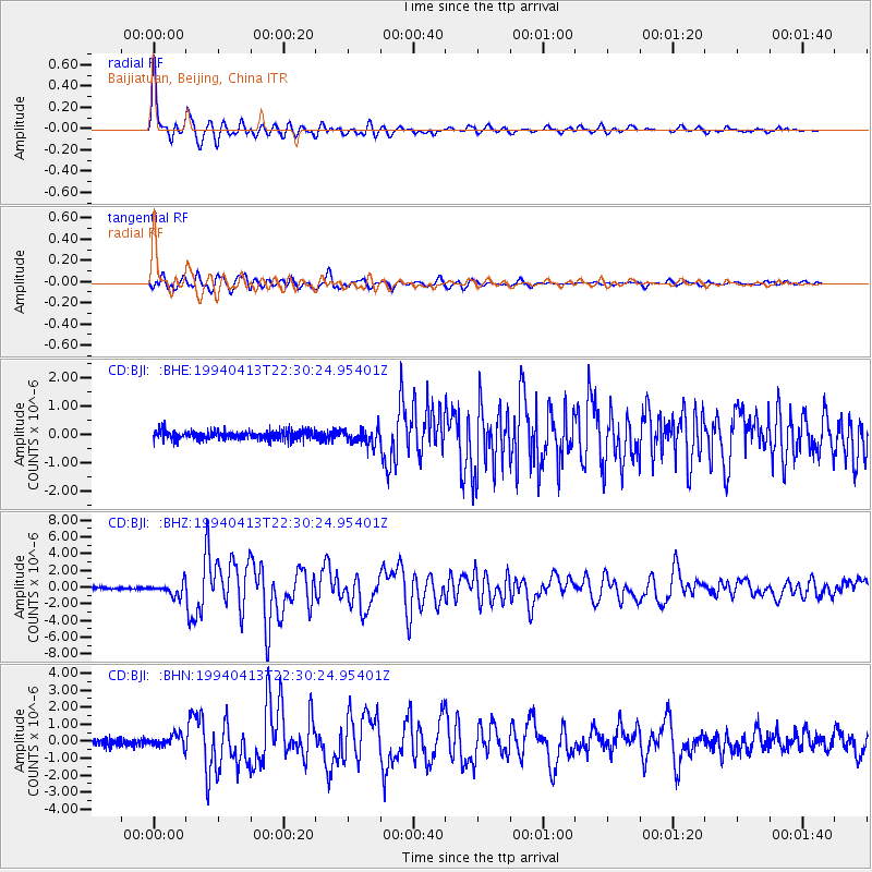
Signal To Noise
| Channel | StoN | STA | LTA |
| CD:BJI: :BHZ:19940413T22:30:24.95401Z | 6.75157 | 7.92513E-7 | 1.1738202E-7 |
| CD:BJI: :BHN:19940413T22:30:24.95401Z | 1.9768924 | 3.4983083E-7 | 1.7695999E-7 |
| CD:BJI: :BHE:19940413T22:30:24.95401Z | 1.6762805 | 2.6992635E-7 | 1.6102696E-7 |
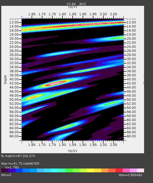
| Arrivals | |
| Ps | 5.3 SECOND |
| PpPs | 17 SECOND |
| PsPs/PpSs | 22 SECOND |

