You are here: Home > Network List > IC - New China Digital Seismograph Network Stations List
> Station HIA Hailar, Neimenggu Province, China > Earthquake Result Viewer
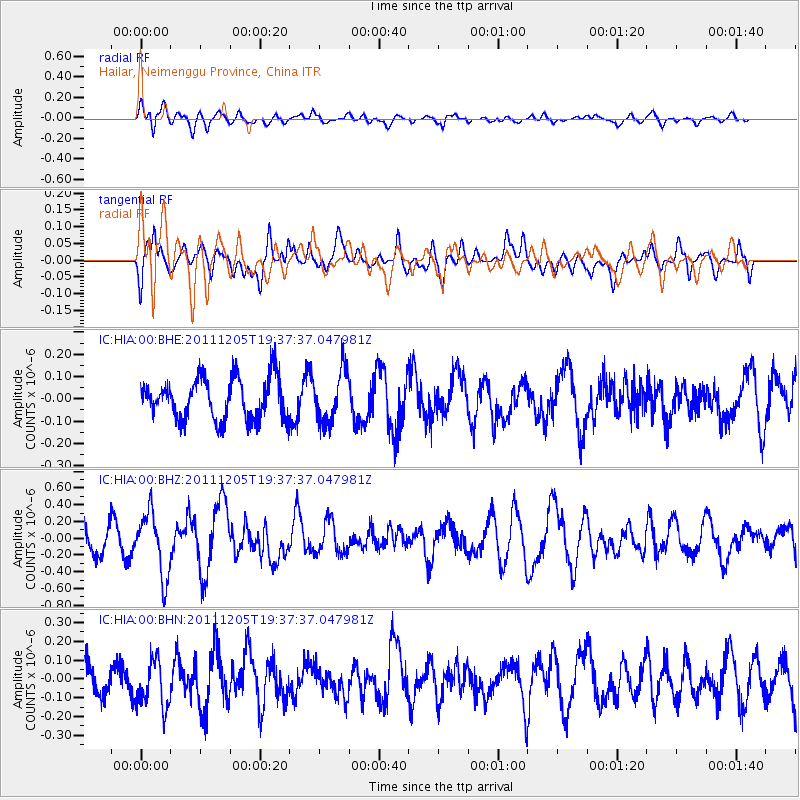
HIA Hailar, Neimenggu Province, China - Earthquake Result Viewer
*The percent match for this event was below the threshold and hence no stack was calculated.
| Earthquake location: |
Irian Jaya Region, Indonesia |
| Earthquake latitude/longitude: |
-4.8/133.6 |
| Earthquake time(UTC): |
2011/12/05 (339) 19:28:36 GMT |
| Earthquake Depth: |
19 km |
| Earthquake Magnitude: |
5.7 MB, 5.6 MS, 5.7 MW |
| Earthquake Catalog/Contributor: |
WHDF/NEIC |
|
| Network: |
IC New China Digital Seismograph Network |
| Station: |
HIA Hailar, Neimenggu Province, China |
| Lat/Lon: |
49.27 N/119.74 E |
| Elevation: |
620 m |
|
| Distance: |
55.2 deg |
| Az: |
348.95 deg |
| Baz: |
163.044 deg |
| Ray Param: |
$rayparam |
*The percent match for this event was below the threshold and hence was not used in the summary stack. |
|
| Radial Match: |
60.19644 % |
| Radial Bump: |
400 |
| Transverse Match: |
68.55974 % |
| Transverse Bump: |
400 |
| SOD ConfigId: |
432046 |
| Insert Time: |
2012-03-08 01:48:39.833 +0000 |
| GWidth: |
2.5 |
| Max Bumps: |
400 |
| Tol: |
0.001 |
|
Signal To Noise
| Channel | StoN | STA | LTA |
| IC:HIA:00:BHZ:20111205T19:37:37.047981Z | 2.2614625 | 3.783351E-7 | 1.6729665E-7 |
| IC:HIA:00:BHN:20111205T19:37:37.047981Z | 1.5903772 | 1.2764892E-7 | 8.026329E-8 |
| IC:HIA:00:BHE:20111205T19:37:37.047981Z | 1.2553374 | 1.1628657E-7 | 9.263372E-8 |
| Arrivals |
| Ps | |
| PpPs | |
| PsPs/PpSs | |


