You are here: Home > Network List > IC - New China Digital Seismograph Network Stations List
> Station HIA Hailar, Neimenggu Province, China > Earthquake Result Viewer
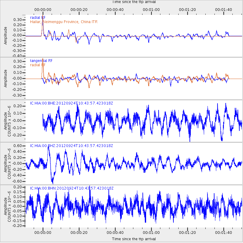
HIA Hailar, Neimenggu Province, China - Earthquake Result Viewer
*The percent match for this event was below the threshold and hence no stack was calculated.
| Earthquake location: |
Tonga Islands |
| Earthquake latitude/longitude: |
-21.2/-174.3 |
| Earthquake time(UTC): |
2012/09/24 (268) 10:31:23 GMT |
| Earthquake Depth: |
10 km |
| Earthquake Magnitude: |
5.7 MB, 5.4 MS, 5.5 MW, 5.5 MW |
| Earthquake Catalog/Contributor: |
WHDF/NEIC |
|
| Network: |
IC New China Digital Seismograph Network |
| Station: |
HIA Hailar, Neimenggu Province, China |
| Lat/Lon: |
49.27 N/119.74 E |
| Elevation: |
620 m |
|
| Distance: |
91.3 deg |
| Az: |
323.246 deg |
| Baz: |
121.527 deg |
| Ray Param: |
$rayparam |
*The percent match for this event was below the threshold and hence was not used in the summary stack. |
|
| Radial Match: |
64.87285 % |
| Radial Bump: |
400 |
| Transverse Match: |
55.068554 % |
| Transverse Bump: |
400 |
| SOD ConfigId: |
478790 |
| Insert Time: |
2013-02-22 22:19:59.112 +0000 |
| GWidth: |
2.5 |
| Max Bumps: |
400 |
| Tol: |
0.001 |
|
Signal To Noise
| Channel | StoN | STA | LTA |
| IC:HIA:00:BHZ:20120924T10:43:57.423018Z | 3.4551928 | 2.7579676E-7 | 7.982095E-8 |
| IC:HIA:00:BHN:20120924T10:43:57.423018Z | 1.512092 | 8.2297106E-8 | 5.4425993E-8 |
| IC:HIA:00:BHE:20120924T10:43:57.423018Z | 0.89626884 | 7.924712E-8 | 8.841892E-8 |
| Arrivals |
| Ps | |
| PpPs | |
| PsPs/PpSs | |


